Peloponnese: Korinthos Hiking trail in oak forest...for everyone
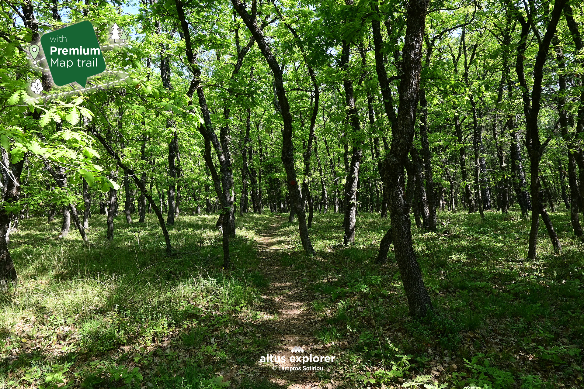

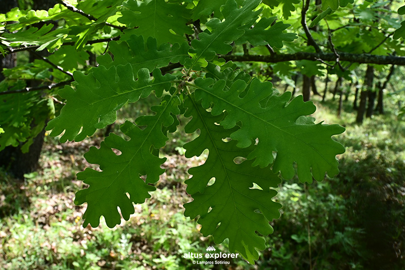
Imagine a natural paradise on earth, where majestic Oaks spread their branches like a natural embrace, creating a magical setting. In an area of approximately 7,000 acres, just a few kilometers away from Attica, in the heart of the Corinthian Mountains, a forest awaits you that offers a unique escape from the tension and stress of everyday life.
If you love adventure, this forest is ideal for an easy hike, exploration and photography of the "natural wonders".
For those seeking a more peaceful experience, the area offers excellent spots for picnics under the foliage, moments of meditation, or even the simplicity of sitting and observing the tranquility around you. The sounds of birds, the coolness of the air and the beauty of the landscape become the ideal setting to recharge your batteries and reconnect with nature.
Whether alone or with friends, a visit to this natural haven of peace promises to fill you with energy, inspiration and a sense of deep well-being.
In this hiking route you will see (available when activating the premium version):
- How to get to the starting point - Two different ones (description & map)
- At which points is there full tree cover, useful especially in a period with enough sunshine. (map)
- Exit points from the hiking route/trail (new feature) (map)
- What you can do if you have limited time for your return (description & map)
- More photos of the route (description & map)
At which points of the trail are there hills and terrain morphology e.g. stones (map)
Points that will inspire you for photography or video recording (description & map)
Many points of interest such as with a view, for relaxing in nature etc. (description & map) - After the route what you can do as well as other technical features and functions
More descriptions available in the premium version

• Bring plenty of water and food with you..

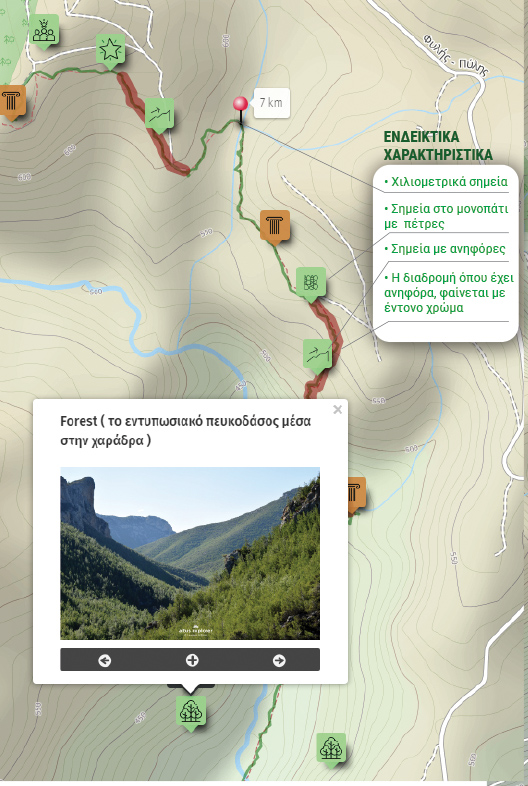
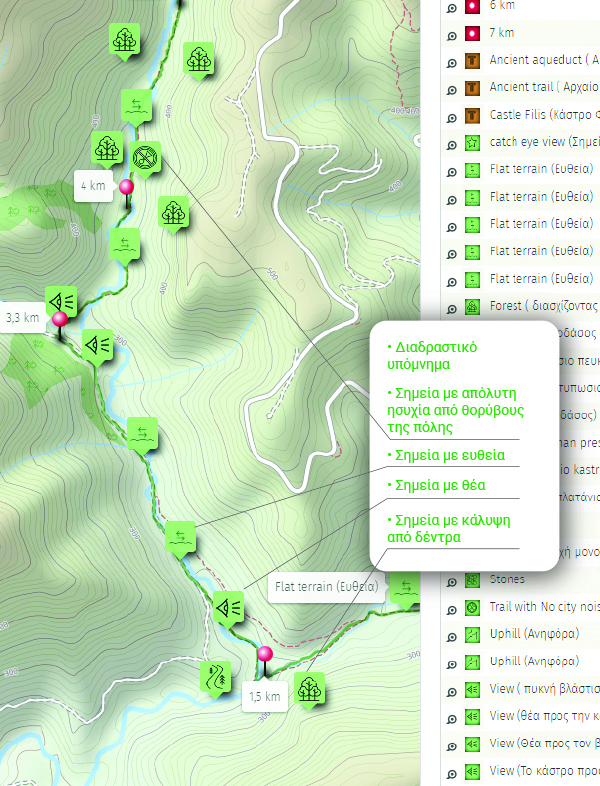
Χάρτης διαδρομής - πεζοπορίας
Ξεκλειδώστε τον αναλυτικό χάρτη πεζοπορίας Permium αυτής της διαδρομής, τα επιπρόσθετα χαρακτηριστικά της, όπως και όλους τους Premium διαθέσιμους πεζοπορικούς χάρτες με μια συνδρομή.

1. Ο Premium πεζοπορικός χάρτης περιλαμβάνει τα παρακάτω χαρακτηριστικά (όποια υπάρχουν στη διαδρομή):
- Σημεία στη διαδρομή με ευθεία, με ανηφόρα (και με έντονο χρώμα), κατηφόρα, Έξοδος.
- Σημεία στη διαδρομή με πέτρες (εφόσον υπάρχει)
- Σημεία φυσικού ενδιαφέροντος (με πυκνό δάσος, με δέντρα, χαμηλή βλάστηση κτλ)
- Εκτυπώστε τον χάρτη για backup (διαθέσιμο μόνο για μεγάλες διαδρομές)
- Σημεία γενικού ενδιαφέροντος (σημεία με θέα, πολιτιστικά μνημεία, κτλ)
- Χιλιομετρικές αποστάσεις, σημεία έναρξης
- Σημεία ενδιαφέροντος με φωτογραφίες
- Catch eye points για φωτογράφιση και video
- κπλ
2. Επιπρόσθετα χαρακτηριστικά διαδρομής
- Download GPΧ
- Πως θα φτάσετε στο σημείο εκκίνησης
- Πλοηγηθείτε στον χάρτη με εντοπισμό της θέσης σας χωρις να κατεβάσετε εφαρμογή (ΒΕΤΑ )
Διαθέσιμος με συνδρομή
Η παρακάτω εικόνα είναι γενικό παράδειγμα experience map με καποια από τα χαρακτηριστικά του και όχι τμήμα της παρούσας διαδρομής.