Corinthia, Lake Doxa, hiking trail with a view from above
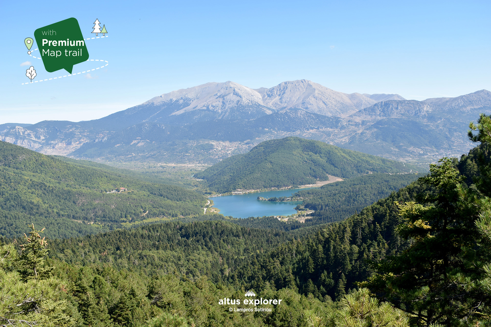

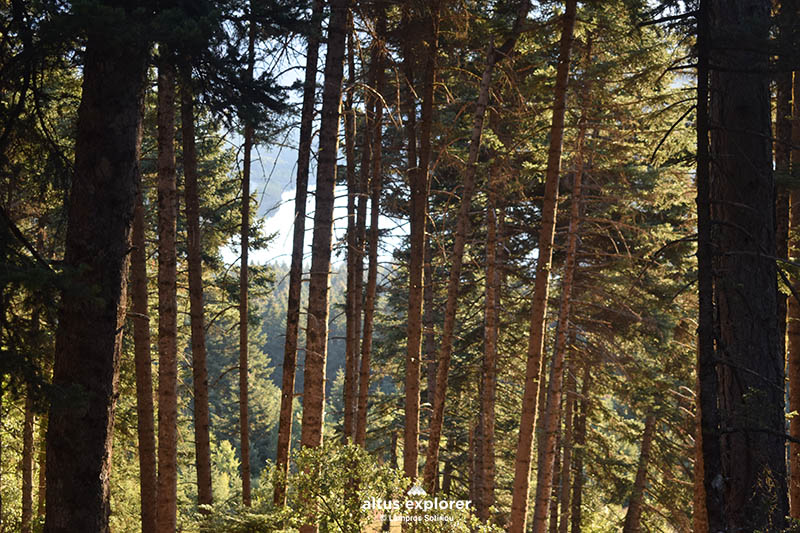
The enchanting route that starts from Lake Doxa highlights the impressive beauty of nature as it is surrounded by tall pine trees, with fir trees adorning the path as we ascend. Although mostly gently uphill, (except for the last mile with a challenging climb to the impressive summit), the trail offers an enjoyable weekend excursion!
The spots with spectacular views of Doxa Lake are quite ...and magical...., the same on the northwest side of the area! Therefore, you can traverse part of the route or choose a spot (of many) on the forest or trail for relaxing or just enjoying nature!
On this hiking route you will see (available on activation of the premium version):
- More photos on most of the route(description & map)
- How to get to the trailhead or other points of interest by car(description & map)
- Where on the trail there is a steep uphill and how to get there. ( map)
- In which parts of the trail there are hills, places with stones, forest cover, kilometric distances (map)
- Points that will inspire you to take photos or videos(description & map)
- Many points of interest such as with a view, relaxing in nature, vegetation (description & map)
Lake Doxa
Lake Doxa is an artificial lake located in mountainous Corinthia, at an altitude of 900 metres. It has an area of approximately 2.5 square kilometres and a maximum depth of 40 metres. Its waters come from streams originating from the surrounding mountains, such as Helmos, Dourdouvanas (Pentelia Mountain).
Lake Doxa is one of the most popular tourist attractions of mountainous Corinthia which. The lake is surrounded by dense forests of spruce and pine, creating an idyllic landscape. The area is ideal for hiking, cycling, nature photography simple relaxation and meditation through the trails. On the lake is the chapel of Agios Fanourios, which is built on a small island in the centre of the lake. The chapel is accessible by boat or by hiking along the shore of the lake.
It is worth mentioning:
On weekends the area gets too crowded especially around the lake and is not recommended for relaxing inside the lake (lakeside). If you decide to walk this particular trail, I suggest arriving early enough to even find parking near the starting point!
Alternatively, you can arrive at the point in the afternoon to stay overnight so that you have the opportunity to enjoy the magical morning, peace and tranquility that the lake offers and then walk part or all of the hiking trail!
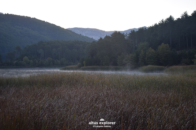 Lake Glory in the early morning
![]()
 Lake Doxa, beginning of the trail
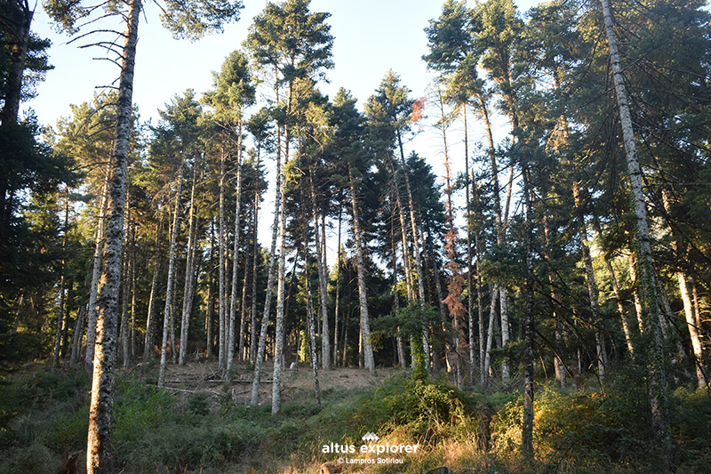
![]()
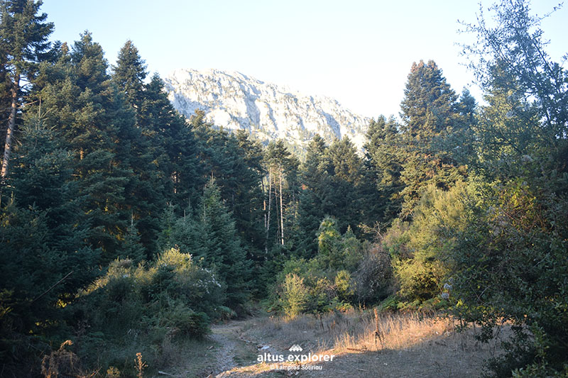
 The view of the lake can be seen at various points from the trail
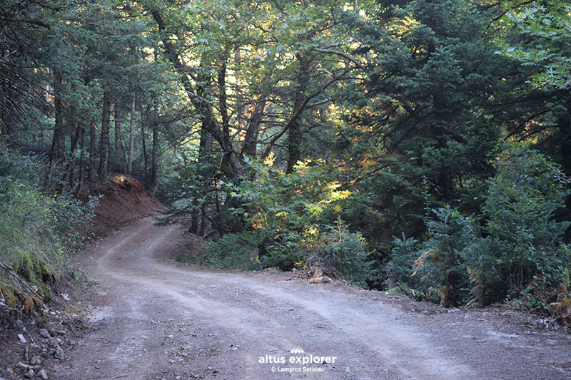 Forest road

- Bring plenty of water and food (if you walk the whole route. Count on the return journey).
- Just before the summit as shown in the map with a bold line (premium map) the climb for almost 1 km is very steep and the field is uneven (there are no trees). There is no danger at this point, but it is advisable to save your strength and enough energy for the last climb. Calculate the return descent.
- Do not cross it during periods of very high temperatures.
Με την ολοκλήρωση της πεζοπορίας σας, προτείνονται τα παρακάτω:
• Μπορείτε να επισκεφτείτε το γραφικό χωριό Αρχαία Φενεός.
• Μπορείτε να επισκεφτείτε το εξωκλήσι Αγίου Φανουρίου στην λίμνη.

Χάρτης διαδρομής - πεζοπορίας
Ξεκλειδώστε τον αναλυτικό χάρτη πεζοπορίας Permium αυτής της διαδρομής, τα επιπρόσθετα χαρακτηριστικά της, όπως και όλους τους Premium διαθέσιμους πεζοπορικούς χάρτες με μια συνδρομή.

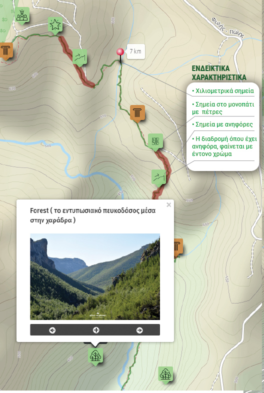
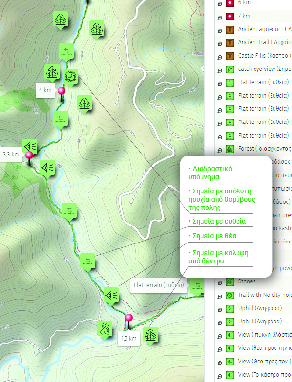
1. Ο Premium πεζοπορικός χάρτης περιλαμβάνει τα παρακάτω χαρακτηριστικά (όποια υπάρχουν στη διαδρομή):
- Σημεία στη διαδρομή με ευθεία, με ανηφόρα (και με έντονο χρώμα), κατηφόρα.
- Σημεία στη διαδρομή με πέτρες (εφόσον υπάρχει)
- Σημεία φυσικού ενδιαφέροντος (με πυκνό δάσος, με δέντρα, χαμηλή βλάστηση, ποτάμια, καταρράκτες, σπηλιές, λίμνες κτλ)
- Εκτυπώστε τον χάρτη για backup (διαθέσιμο μόνο για μεγάλες διαδρομές)
- Σημεία γενικού ενδιαφέροντος (σημεία με θέα, πολιτιστικά μνημεία, αρχαιολογικοί χώροι, κτλ)
- Χιλιομετρικές αποστάσεις, σημεία έναρξης
- Σημεία ενδιαφέροντος με φωτογραφίες
- Catch eye points για φωτογράφιση και video
2. Επιπρόσθετα χαρακτηριστικά διαδρομής
- Download GPΧ
- Πως θα φτάσετε στο σημείο εκκίνησης
- Πλοηγηθείτε στον χάρτη με εντοπισμό της θέσης σας χωρις να κατεβάσετε εφαρμογή (ΒΕΤΑ - προσωρινά δοκιμαστική έκδοση)
Διαθέσιμος με συνδρομή
Η παρακάτω εικόνα είναι γενικό παράδειγμα experience map με καποια από τα χαρακτηριστικά του και όχι τμήμα της παρούσας διαδρομής.