Arcadia, Mainalo mountain: Hiking trail and forest route

Menalon: an iconic sense of harmony and serenity
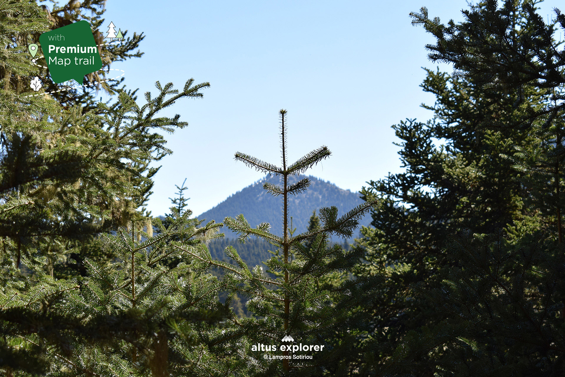
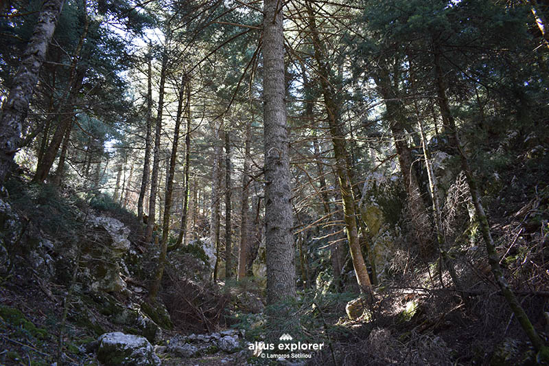
The route of the E4 trail in Mainalo starts just outside the village of Vytina (point on the map as start point A, green line and then blue to the point Katafigio. You can see below how to get to start point A ), it is predominantly forested, with passes through fir and pine forests. The route is relatively challenging at first, but offers unique views with a sense of harmony, serenity, lush nature throughout the mountain range!
The Forest Road is a circular road suitable for hiking, mountain running and mountain biking but also accessible by car*. It starts just outside Vytina (map Start point Start point B in red. You can see below how to get to Start Point B) or you can start from the E4 trail(Start Point A) and enter the forestry from two different points as shown on the map. The whole forestry is in excellent condition, "accompanied" by a lovely fir forest, offers (see map) spots for relaxation, picnics, meditation, great photography, and many places with views to the core of the mountain and to the village of Vytina.
On both routes away from the noise of the city you are given the opportunity to disconnect from everyday life to indulge in the sounds of nature and the harmony of nature!
Of course it is not necessary to cross the whole hiking trail or forest trail! Just get into nature and enjoy every moment or find the best place that suits you and experience what it has to offer!
![]()
On this hiking and forest trail you will see (available on premium version activation):
- More photos for both the E4 trail and the forest trail (circular route for mountain biking, mountain running and accessible by car*) most of the route(description & map)
- How to reach the start of the trail or the forest trail or other points of interest by car(description & map)
- At which points of the trail and the forest road (circular route) there is a straight route, uphill, downhill ( map indication)
- Points that will inspire you for photography or video shooting(description & map)
- Points on the trail or forest road with stones(description & map)
Many points of interest such as with a view, for relaxing in nature, vegetation, natural elements (description & map)
![]()
Mount Mainalo is one of the most important mountains of the Peloponnese, with an altitude of 2,377 meters at the peak of Ostrakina. It is located in Arcadia and has a rich flora and fauna, as well as many historical and cultural attractions.
The E4 trail is a European hiking trail that crosses the whole of Europe, from Spain to Greece. In Mainalon, the E4 trail crosses the mountain from west to east, starting from Dara and ending in Tripoli.
![]()
Trail starting just outside the village of Vytina
![]()
 Start of the trail as we enter the fir forest. Relatively uphill route
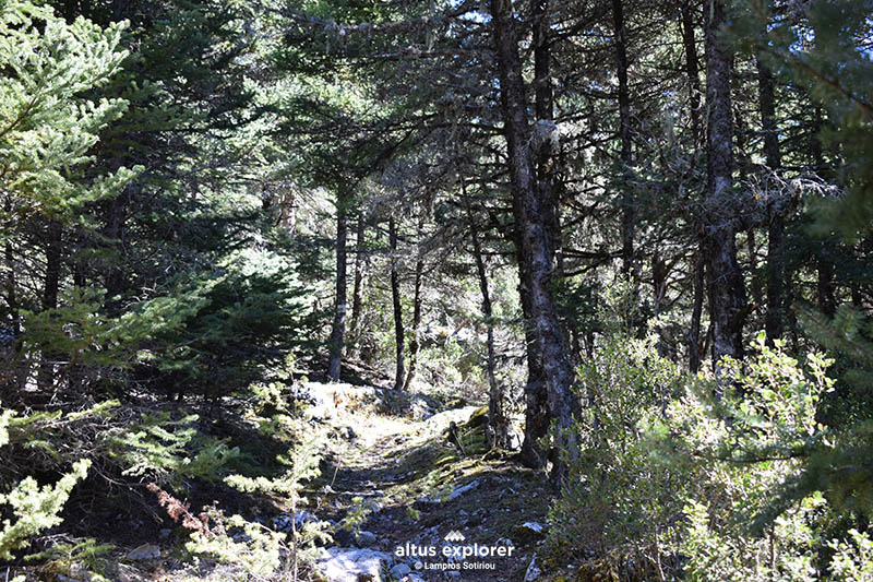 Hiking trail in the forest Relatively uphill with a few stones
![]()
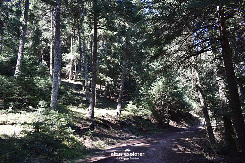 Forest road
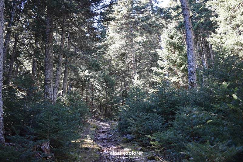
Forest road suitable for mountain biking and access on foot or by car*
![]()
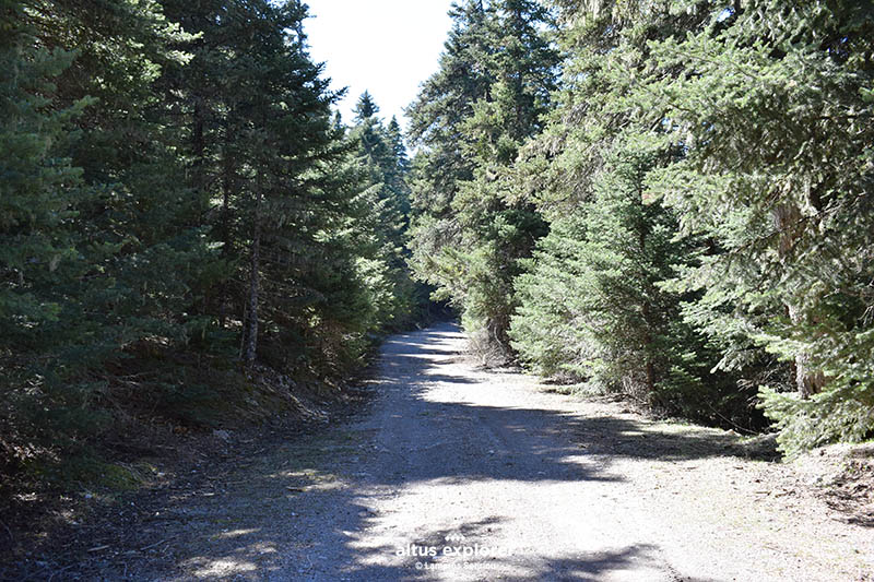 Forest road in Mainalo. Suitable for cycling, mountain running (circular route)
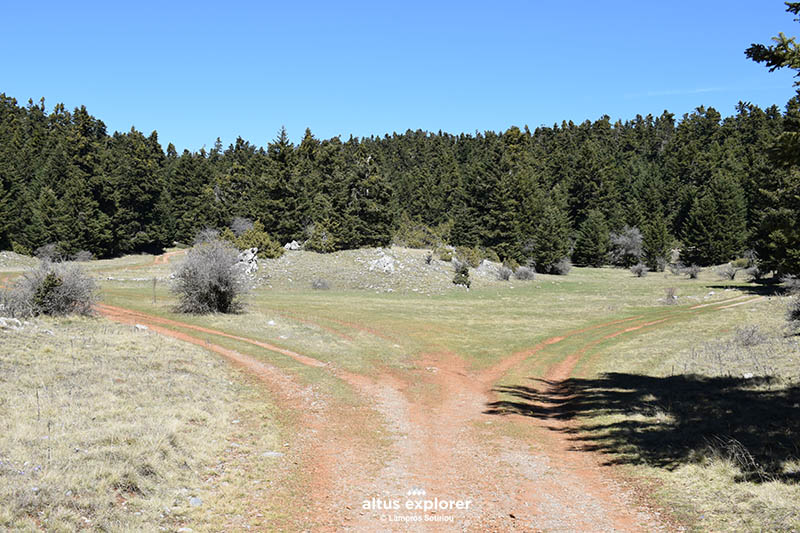 Forest road in Mainalo with access by car*, bicycle or mountain running.
1/2
Features about the trail
2/2
Features for forest route (circular route)
![]()

- Bring plenty of water and food with you (if you cross the whole route. Calculate the return journey).
- The mountain can be cold and rainy, so it is important to be prepared for all conditions.
Upon completion of your hike, the following are suggested:
- The village of Vytina, one of the most beautiful villages in Greece
- The ski resort of Menalon
- The top of Ostrakina
- The village of Levidi
- The city of Tripoli

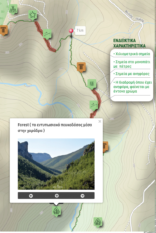
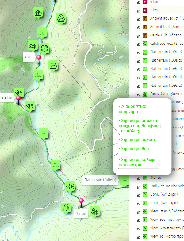
Χάρτης διαδρομής - πεζοπορίας
Ξεκλειδώστε τον αναλυτικό χάρτη πεζοπορίας Permium αυτής της διαδρομής, τα επιπρόσθετα χαρακτηριστικά της, όπως και όλους τους Premium διαθέσιμους πεζοπορικούς χάρτες με μια συνδρομή.

1. Ο Premium πεζοπορικός χάρτης περιλαμβάνει τα παρακάτω χαρακτηριστικά (όποια υπάρχουν στη διαδρομή):
- Σημεία στη διαδρομή με ευθεία, με ανηφόρα (και με έντονο χρώμα), κατηφόρα.
- Σημεία στη διαδρομή με πέτρες (εφόσον υπάρχουν)
- Σημεία φυσικού ενδιαφέροντος (με πυκνό δάσος, με δέντρα, χαμηλή βλάστηση, κτλ)
- Εκτυπώστε τον χάρτη για backup (διαθέσιμο μόνο για μεγάλες διαδρομές)
- Σημεία γενικού ενδιαφέροντος (σημεία με θέα, πολιτιστικά μνημεία, αρχαιολογικοί χώροι, κτλ)
- Χιλιομετρικές αποστάσεις, σημεία έναρξης
- Σημεία ενδιαφέροντος με φωτογραφίες
- Catch eye points για φωτογράφιση και video
2. Επιπρόσθετα χαρακτηριστικά διαδρομής
- Download GPΧ
- Πως θα φτάσετε στο σημείο εκκίνησης
- Δείτε τη θέση σας στο χάρτη με όλα τα σημεία ενδιαφέροντος χωρίς να κατεβάσετε εφαρμογή (ΒΕΤΑ)
Διαθέσιμος με συνδρομή
Η παρακάτω εικόνα είναι γενικό παράδειγμα experience map με καποια από τα χαρακτηριστικά του και όχι τμήμα της παρούσας διαδρομής.