Mainalo mountain: Hiking trail in forest - Shettler - Ski resort (circular)

Among the forests of Menalon: An exciting hike through spruce forests, " detoxing " from everyday life and creative discoveries!
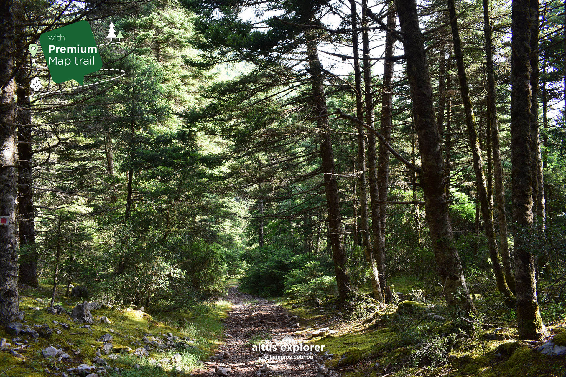
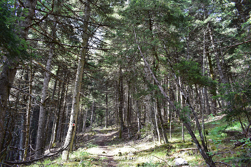
The hiking trail starts from the village of Levidi in the prefecture of Arcadia. Most of it passes through a beautiful fir forest, from the Mountaineering Refuge "Menalon" EOS Tripoli, the ski resort, impressive points overlooking the green slopes of the mountain, various points that you can choose for relaxation and tranquility, as well as an impressive cave in the western part of the route (see map note).
On this hiking route you will see (available on activation of the premium version):
- More photos on most of the route(description & map)
- How to get to the trailhead or other points of interest by car(description & map)
- Where on the trail there is a straight route and how to get there. ( map)
- In which parts of the trail there are hills(map)
- Points that will inspire you to take photos or videos(description & map)
- Many points of interest such as with a view, for relaxing in nature, vegetation, natural elements such as a cave(description & map)
The marking of the trail and in general of the whole route is excellent, well thought out, so you can see it at any point! There is signage marking the trail suitable for downhill - mountain biking (see map ).
![]()
 Hiking trail
 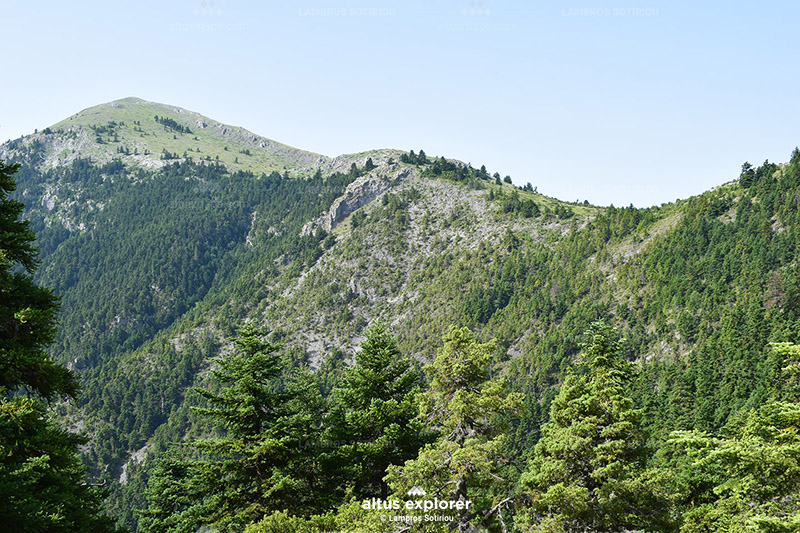 View to the small peak of Prophet Elias
Path: Levidi Village - Shelter - Ski Resort
Path: Ski - (cycling route) - Levidi village

• Have plenty of water and food with you.

Upon completion of your hike, the following are suggested:
• You can visit the picturesque Vytina
• ΥThere are other trails in Mainalo both for hiking, picnicking or mountain running and wonderful forest roads for mountain biking. Many trails are accessible by car. Below are the routes available

Χάρτης διαδρομής - πεζοπορίας
Ξεκλειδώστε τον αναλυτικό χάρτη πεζοπορίας Permium αυτής της διαδρομής, τα επιπρόσθετα χαρακτηριστικά της, όπως και όλους τους Premium διαθέσιμους πεζοπορικούς χάρτες με μια συνδρομή.

1. Ο Premium πεζοπορικός χάρτης περιλαμβάνει τα παρακάτω χαρακτηριστικά (όποια υπάρχουν στη διαδρομή):
- Σημεία στη διαδρομή με ευθεία, με ανηφόρα (και με έντονο χρώμα), κατηφόρα.
- Σημεία στη διαδρομή με πέτρες (εφόσον υπάρχει)
- Σημεία φυσικού ενδιαφέροντος (με πυκνό δάσος, με δέντρα, χαμηλή βλάστηση, ποτάμια, καταρράκτες, σπηλιές, λίμνες κτλ)
- Εκτυπώστε τον χάρτη για backup (διαθέσιμο μόνο για μεγάλες διαδρομές)
- Σημεία γενικού ενδιαφέροντος (σημεία με θέα, πολιτιστικά μνημεία, αρχαιολογικοί χώροι, κτλ)
- Χιλιομετρικές αποστάσεις, σημεία έναρξης
- Σημεία ενδιαφέροντος με φωτογραφίες
- Catch eye points για φωτογράφιση και video
2. Επιπρόσθετα χαρακτηριστικά διαδρομής
- Download GPΧ
- Πως θα φτάσετε στο σημείο εκκίνησης
- Πλοηγηθείτε στον χάρτη με εντοπισμό της θέσης σας χωρις να κατεβάσετε εφαρμογή (ΒΕΤΑ - προσωρινά δοκιμαστική έκδοση)
Διαθέσιμος με συνδρομή
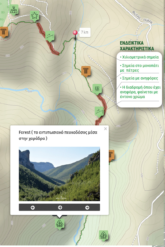
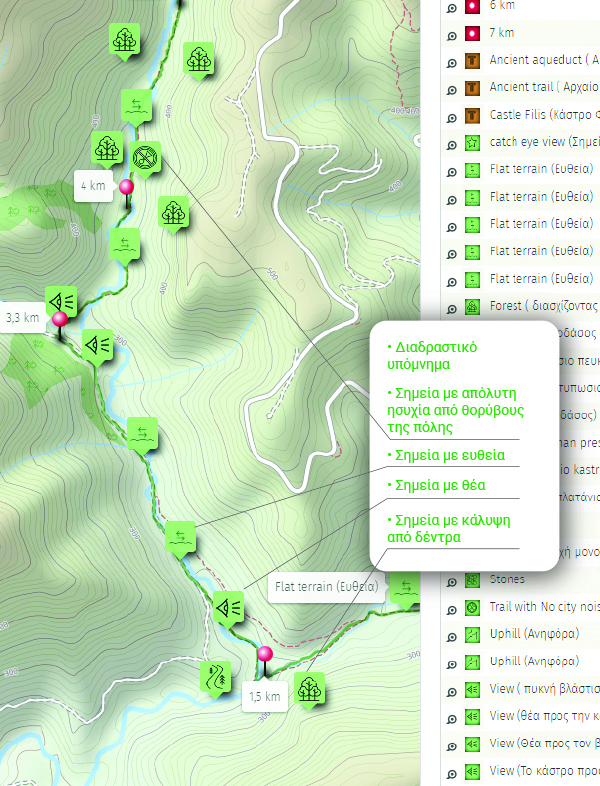
Η παρακάτω εικόνα είναι γενικό παράδειγμα experience map με καποια από τα χαρακτηριστικά του και όχι τμήμα της παρούσας διαδρομής.