Lousios (Lucius) River - Hiking trail

The gorge of Lucius: a living witness of history, a magical hiking route with cultural experiences and a strong ....water element!
Hiking through this "natural cathedral" is an experience that goes beyond mere recreation. The trail, which crosses the gorge almost from end to end, offers a unique opportunity to explore a place where nature coexists harmoniously with human creations.
Starting from the picturesque Paleochori, the trail, well-marked in excellent condition and accessible, leads to the heart of the forest with many changes in the rich vegetation.
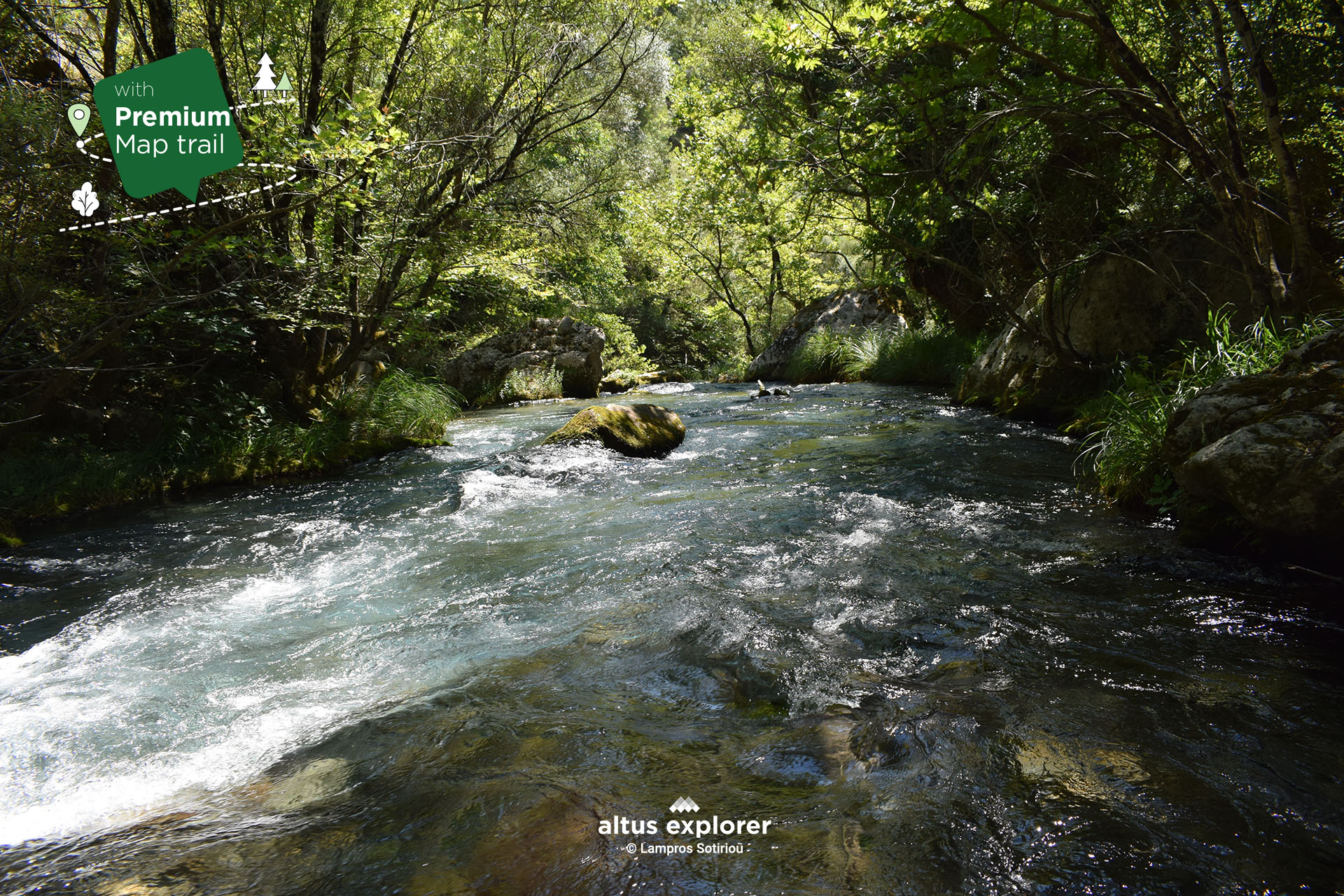
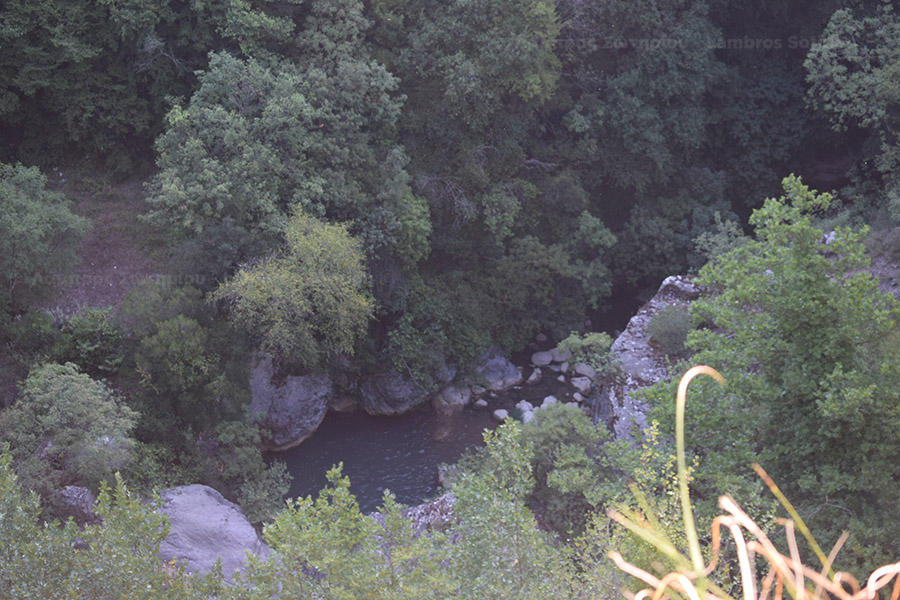
As we descend, our view is lost in the rushing intensity of the Lousios, whose waters run between imposing rocks.
The Byzantine monasteries, such as the Monastery of Filosofos and the Old Monastery of Filosofos, - "hidden school", the Monastery of Agios Ioannos Prodromos are living monuments of a rich spiritual tradition. The traditional watermills, witnesses of another era, inform us about the way of life of our ancestors.
The route ends at the impressive stone bridge of Kokkoris (where you have access to the river), which stands proudly next to the archaeological site of Gortys and the Asclepieion. A hiking trip to Luciusio offers a unique experience to get in touch with the history and culture of this wonderful place.
On this hiking route you will see (available on activation of the premium version):
- More photos on most of the route(description & map)
- How to get to the trailhead or other points of interest by car(description & map)
- Where on the trail there is a straight route and how to get there. ( map)
- In which parts of the trail there are hills(map)
- Points that will inspire you to take photos or videos(description & map)
Many points of interest such as views, relaxing in nature, vegetation, natural and cultural monuments(description & map)
![]()
 Lucius from the beginning of the trail
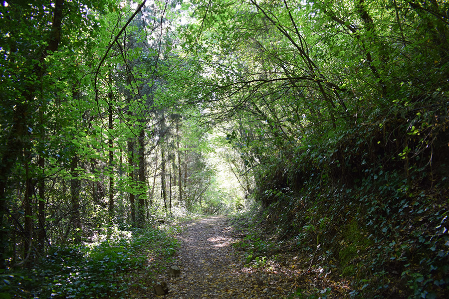 Forest path parallel to the river
![]()
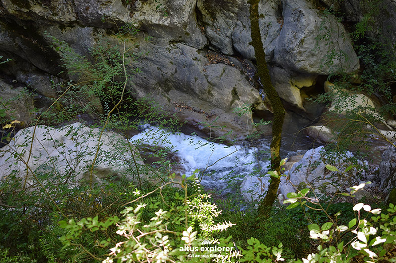 Lucius from above
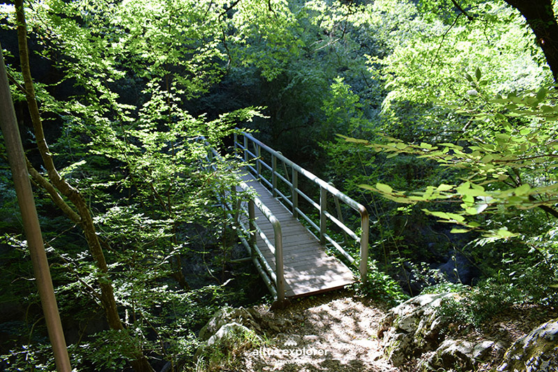 Metal bridge

• Throughout the trail there is no direct access to the river except at the end of the trail, i.e. at the Kokkoris stone bridge.
• The hiking route as shown on the map (premium map) is not circular so calculate your time and supplies for the return.

Χάρτης διαδρομής - πεζοπορίας
Ξεκλειδώστε τον αναλυτικό χάρτη πεζοπορίας Permium αυτής της διαδρομής, τα επιπρόσθετα χαρακτηριστικά της, όπως και όλους τους Premium διαθέσιμους πεζοπορικούς χάρτες με μια συνδρομή.

1. Ο Premium πεζοπορικός χάρτης περιλαμβάνει τα παρακάτω χαρακτηριστικά (όποια υπάρχουν στη διαδρομή):
- Σημεία στη διαδρομή με ευθεία, με ανηφόρα (και με έντονο χρώμα), κατηφόρα.
- Σημεία στη διαδρομή με πέτρες (εφόσον υπάρχει)
- Σημεία φυσικού ενδιαφέροντος (με πυκνό δάσος, με δέντρα, χαμηλή βλάστηση, ποτάμια, καταρράκτες, σπηλιές, λίμνες κτλ)
- Εκτυπώστε τον χάρτη για backup (διαθέσιμο μόνο για μεγάλες διαδρομές)
- Σημεία γενικού ενδιαφέροντος (σημεία με θέα, πολιτιστικά μνημεία, αρχαιολογικοί χώροι, κτλ)
- Χιλιομετρικές αποστάσεις, σημεία έναρξης
- Σημεία ενδιαφέροντος με φωτογραφίες
- Catch eye points για φωτογράφιση και video
2. Επιπρόσθετα χαρακτηριστικά διαδρομής
- Download GPΧ
- Πως θα φτάσετε στο σημείο εκκίνησης
- Πλοηγηθείτε στον χάρτη με εντοπισμό της θέσης σας χωρις να κατεβάσετε εφαρμογή (ΒΕΤΑ - προσωρινά δοκιμαστική έκδοση)
Διαθέσιμος με συνδρομή
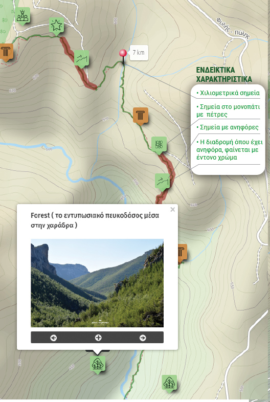
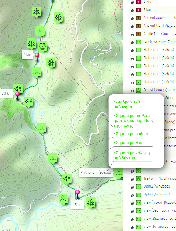
Η παρακάτω εικόνα είναι γενικό παράδειγμα experience map με καποια από τα χαρακτηριστικά του και όχι τμήμα της παρούσας διαδρομής.