Meteora: Hiking trail to the "monks' prisons" / monks' retreat

Every hiking trail in Meteora offers an unforgettable experience, full of breathtaking images. Here, the visitor is immersed in a world where rich nature, impressive monasteries, steep cliffs and eerie caves create a mystical atmosphere that captivates the senses and evokes awe.
This small but charming hiking trail starts next to a field, close to the road, and in a small section connects to the European E4 trail. The route passes through dense and lush vegetation, with trees such as beech, chestnut and plane trees offering shade and coolness. Although the path branches off at several points, and the options can seem confusing, don't worry - with the help of the map, it's almost impossible to get lost.
![]()
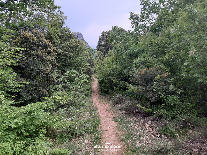 The start of the hiking trail
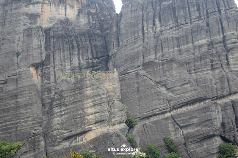
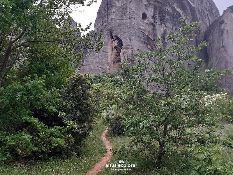 Crossing the trail with a view of one of the impressive rocks
The trail ends at the entrance of an impressive rock, where, according to local tradition, the so-called "monks' prisons" were once located. Although it is not entirely clear whether they were actually prisons or perhaps a retreat for deep contemplation, the sense of mystery that the place exudes is unique.
The trail is easy and passable, with no steep climbs or descents, except at the last point where, if you choose, you can climb up to the entrance of the rock cave. The climb can be done with the help of a rope or even without it, as it is not particularly difficult. Along the route, the view of the impressive rocks of Meteora is magnificent, making you feel part of this ancient and imposing landscape.
![]()
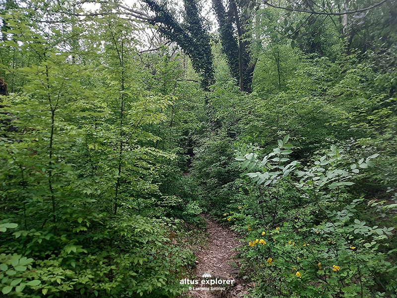 Lush vegetation all along the trail
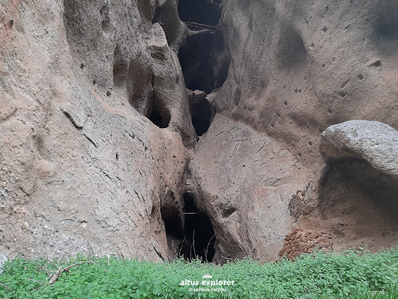 Before the entrance to the rock cave
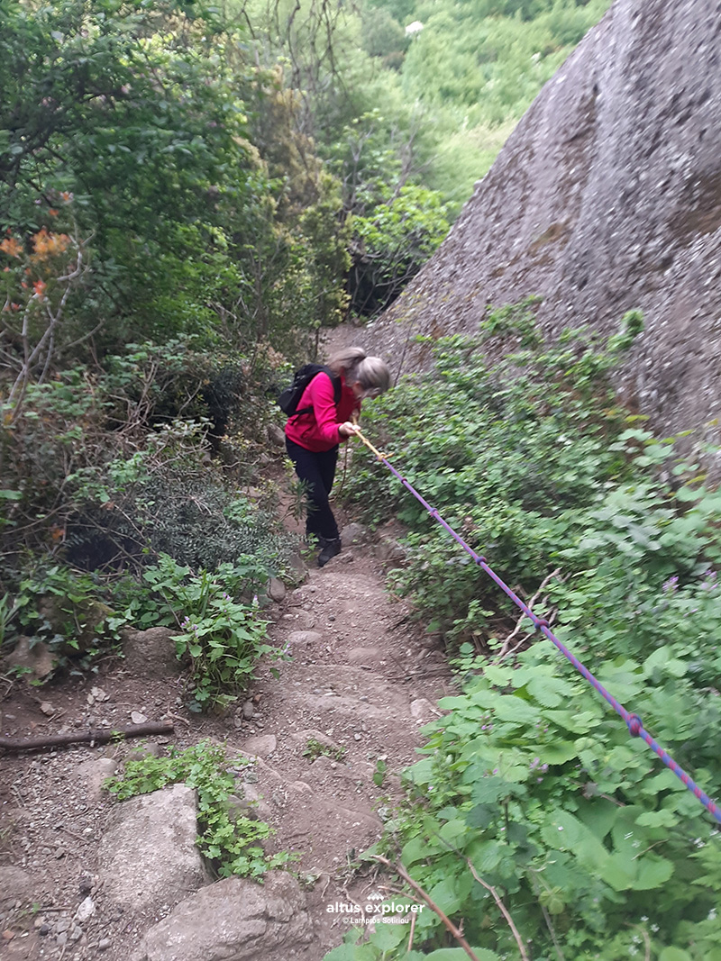
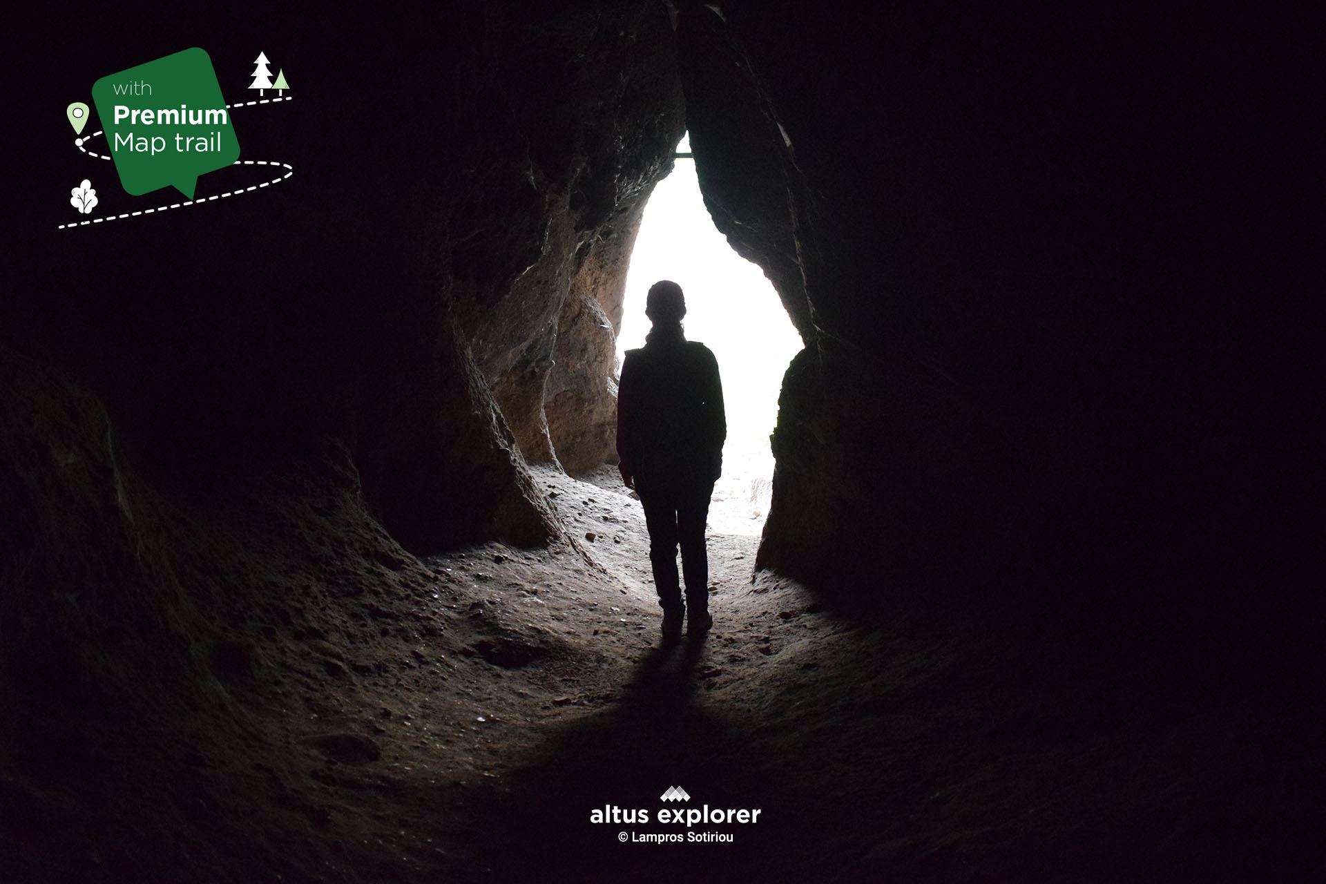
![]()
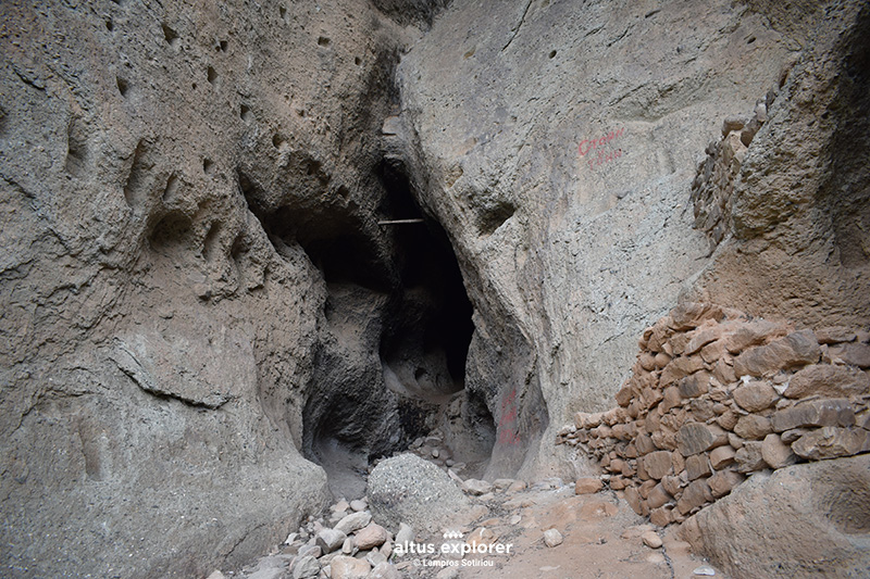 The entrance
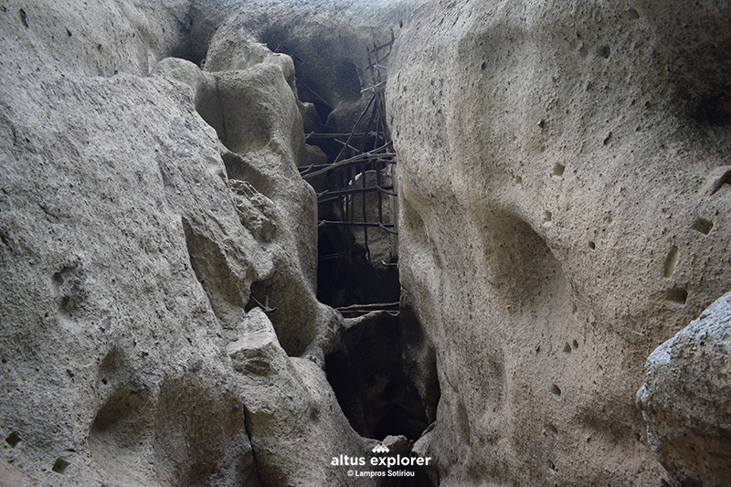 The upper part of the entrance, cells

Χάρτης διαδρομής - πεζοπορίας
Ξεκλειδώστε τον αναλυτικό χάρτη πεζοπορίας Permium αυτής της διαδρομής, τα επιπρόσθετα χαρακτηριστικά της, όπως και όλους τους Premium διαθέσιμους πεζοπορικούς χάρτες με μια συνδρομή.

1. Ο Premium πεζοπορικός χάρτης περιλαμβάνει τα παρακάτω χαρακτηριστικά (όποια υπάρχουν στη διαδρομή):
- Σημεία στη διαδρομή με ευθεία, με ανηφόρα (και με έντονο χρώμα), κατηφόρα.
- Σημεία στη διαδρομή με πέτρες (εφόσον υπάρχει)
- Σημεία φυσικού ενδιαφέροντος (με πυκνό δάσος, με δέντρα, χαμηλή βλάστηση, ποτάμια, καταρράκτες, σπηλιές, λίμνες κτλ)
- Εκτυπώστε τον χάρτη για backup (διαθέσιμο μόνο για μεγάλες διαδρομές)
- Σημεία γενικού ενδιαφέροντος (σημεία με θέα, πολιτιστικά μνημεία, αρχαιολογικοί χώροι, κτλ)
- Χιλιομετρικές αποστάσεις, σημεία έναρξης
- Σημεία ενδιαφέροντος με φωτογραφίες
- Catch eye points για φωτογράφιση και video
2. Επιπρόσθετα χαρακτηριστικά διαδρομής
- Download GPΧ
- Πως θα φτάσετε στο σημείο εκκίνησης
- Πλοηγηθείτε στον χάρτη με εντοπισμό της θέσης σας χωρις να κατεβάσετε εφαρμογή (ΒΕΤΑ - προσωρινά δοκιμαστική έκδοση)
Διαθέσιμος με συνδρομή
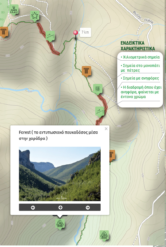
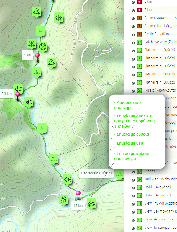
Η παρακάτω εικόνα είναι γενικό παράδειγμα experience map με καποια από τα χαρακτηριστικά του και όχι τμήμα της παρούσας διαδρομής.