

")
Attica: Hymettus, hiking trail from Glyfada location (Terpsithea)
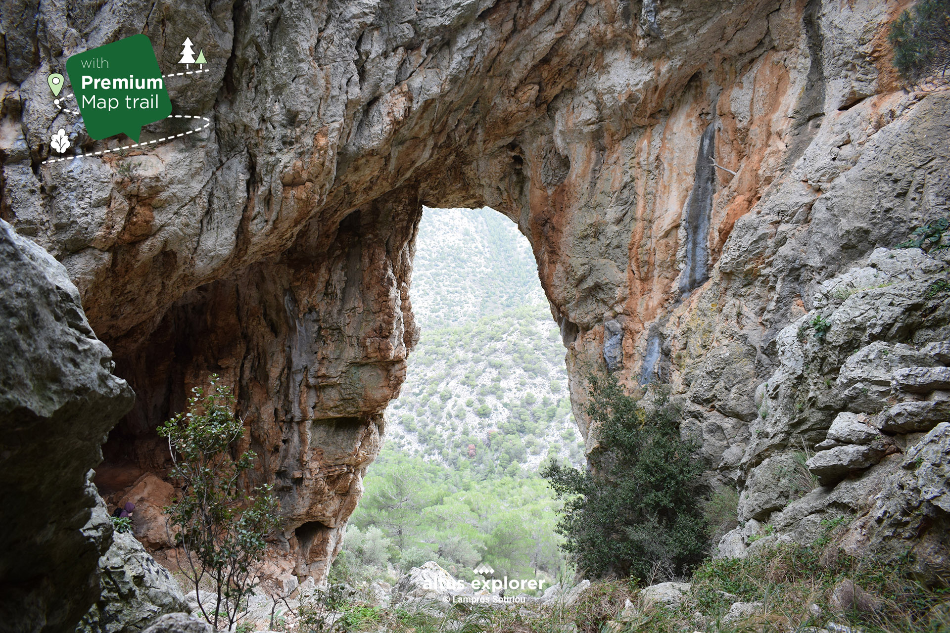

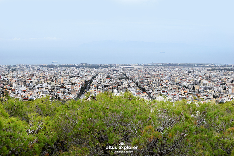
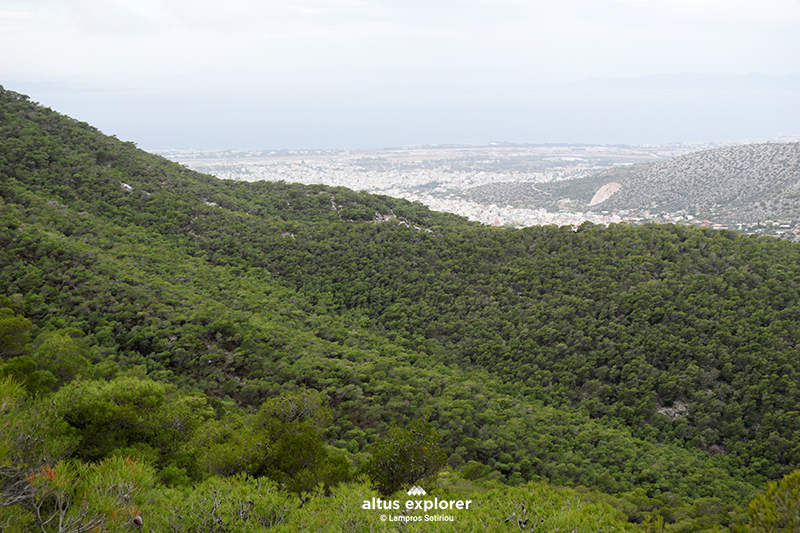
It is incredibly exciting to experience the magic of nature with just a few steps of hiking, taking yourself away from the hustle and bustle of the city. On the hiking trail on Mount Ymittos, you suddenly find yourself in a beautiful and dense pine forest, and soon you are confronted with the grandeur of a mysterious "Trypia" cave that opens up in front of you.
This surprising route starts from Terpsithea in Glyfada, offering a journey towards contemplative nature. You can also choose to climb from the back side of the mountain, at the Stavros position, discovering new beauties at every step.
For those seeking inner peace and meditation, the tranquility of the place and the wild charm of the mountain are a source of inspiration that truly awaken the senses.
So explore this beautiful route and indulge in the magic of nature, immersing yourself in a world where tranquility meets and coexists with wild beauty!!!
On this hiking route you will see (available on activation of the premium version):
- How to get to the starting point (description & map )
- What to look out for on the route.
- Alternative waypoints to reach your destination.
- More photos of the route(description & map)
- At which parts of the trail there is a straight path. ( map)
- In which parts of the trail there are hills and terrain morphology e.g. stones(map)
- Points that will inspire you to take photos or videos(description & map)
- Many points of interest such as with a view, for relaxing in nature, places without city noise etc.(description & map)
![]()
 Going up the hiking trail
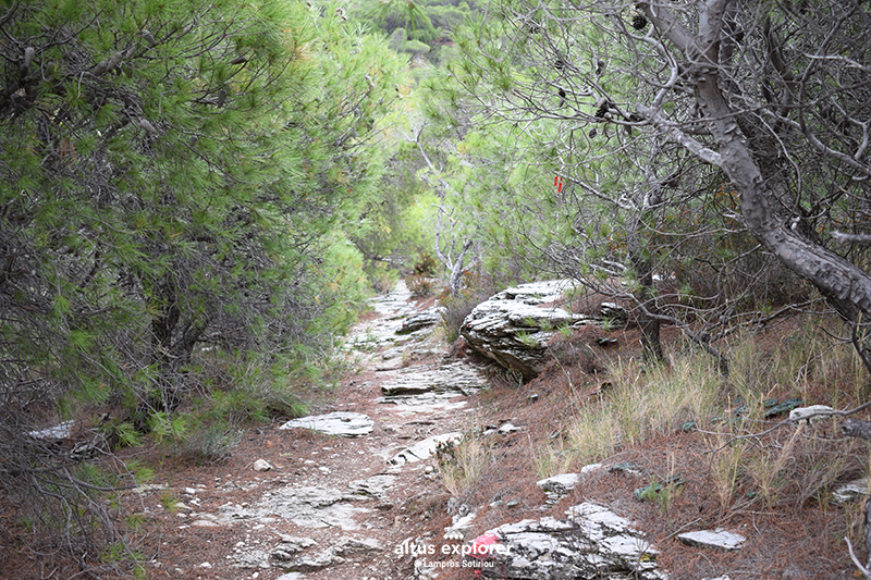 Pine forest along the hiking trail
Impressive and well hidden from civilization pine forest in Ymittos
More descriptions available and features in the premium version

- Bring plenty of water with you (if you walk the whole route. Count on the return journey).

Χάρτης διαδρομής - πεζοπορίας
Ξεκλειδώστε τον αναλυτικό χάρτη πεζοπορίας Permium αυτής της διαδρομής, τα επιπρόσθετα χαρακτηριστικά της, όπως και όλους τους Premium διαθέσιμους πεζοπορικούς χάρτες με μια συνδρομή.

1. Ο Premium πεζοπορικός χάρτης περιλαμβάνει τα παρακάτω χαρακτηριστικά (όποια υπάρχουν στη διαδρομή):
- Σημεία στη διαδρομή με ευθεία, με ανηφόρα (και με έντονο χρώμα), κατηφόρα.
- Σημεία στη διαδρομή με πέτρες (εφόσον υπάρχει)
- Σημεία φυσικού ενδιαφέροντος (με πυκνό δάσος, με δέντρα, χαμηλή βλάστηση, λίμνες κτλ)
- Εκτυπώστε τον χάρτη για backup (διαθέσιμο μόνο για μεγάλες διαδρομές)
- Σημεία γενικού ενδιαφέροντος (σημεία με θέα, πολιτιστικά μνημεία, αρχαιολογικοί χώροι, κτλ)
- Εναλλακτικά σημεία της διαδρομής για να φτάσετε στον προορισμό σας
- Χιλιομετρικές αποστάσεις, σημεία έναρξης
- Σημεία ενδιαφέροντος με φωτογραφίες
- Catch eye points για φωτογράφιση και video
2. Επιπρόσθετα χαρακτηριστικά διαδρομής
- Download GPΧ
- Πως θα φτάσετε στο σημείο εκκίνησης
- Πλοηγηθείτε στον χάρτη με εντοπισμό της θέσης σας χωρις να κατεβάσετε εφαρμογή (ΒΕΤΑ - προσωρινά δοκιμαστική έκδοση)
Διαθέσιμος με συνδρομή
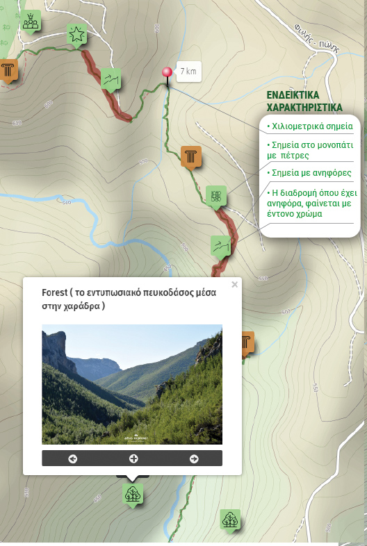
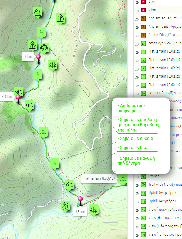
Η παρακάτω εικόνα είναι γενικό παράδειγμα experience map με καποια από τα χαρακτηριστικά του και όχι τμήμα της παρούσας διαδρομής.