Attica: parnitha mountai hiking trail

The treasures of Attica nature so close!
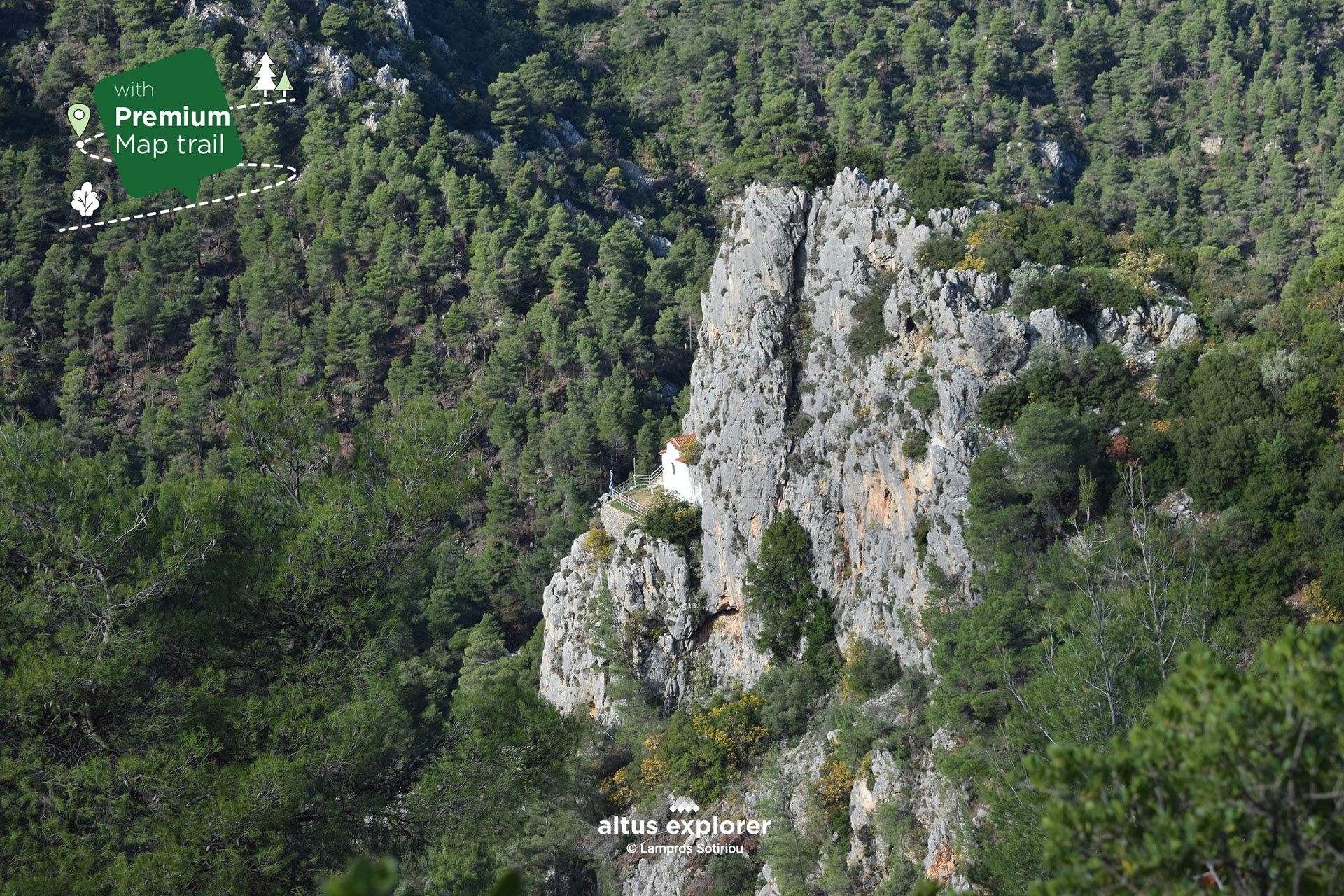
Between the dense nature and the fragrant pine forests of Parnitha, there is a route that many people ignore, but those who dare discover its beauty. It is the path that starts just outside Vlora. This hiking route combines extensive forest roads that lead you through the trees, with prominent views to the peaks of Parnitha and of course, the magical chapel of Agia Marina. An oasis of calm in this heaven of nature.
This route runs along a scenic forest road, the beauty of which comes from the variety of flora and birds you encounter as you walk. As you progress, the meadows spread out before you, presenting stunning views of Parnitha. The suitability of this route for hiking is excellent, as the combination of the forest road and the small hiking trail offers a pleasant hiking experience.
Arriving at the chapel of Agia Marina, you are immersed in an atmosphere of peace and tranquillity. This church is a source of inspiration and renewal. This route is more than just a hike. It is an experience that awakens your senses, connects you with nature and leaves you with indelible images of nature's beauty in your memory.
It is an adventure worth experiencing to witness the magic of nature and the energy of a religious site that remains alive in this sacred corner of Parnitha.
On this hiking route you will see (available on activation of the premium version)
- More photos on most of the route(description & map)
- How to get to part of the route by car and what other options you have(description & map)
- At which parts of the trail there is a direct route and how to get there. ( map)
- In which parts of the trail there are hills(map)
- Points that will inspire you to take photos or videos(description & map)
- Many points of interest such as with a view, for relaxing in nature, vegetation, <<special places of nature>>> places without city noise etc.(description & map)
- After the ride what you can do as well as other technical features and functions
- What to look out for
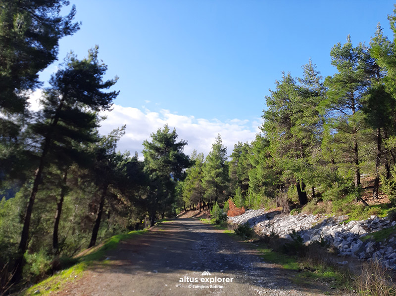
Forest road
You:
- Start the hike on foot from the beginning of the trail where we start (see map)
- Walk the trail from the nearest point where we suggest (see map)
- Reach the beginning of the trail by car. (Note that to reach the trailhead by car you will have to drive on a dirt road. The dirt road is in good condition. However, avoid driving on the dirt road if it has rained in the past few days or is going to rain.)
Confirm if something happens to your car if your roadside assistance will be able to pick you up at this point.
Note that the dirt road you will have to cross by car is in the Parnitha Park and not near the city!
![]()
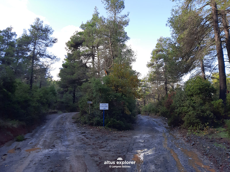 Forest road with a sign pointing to the right
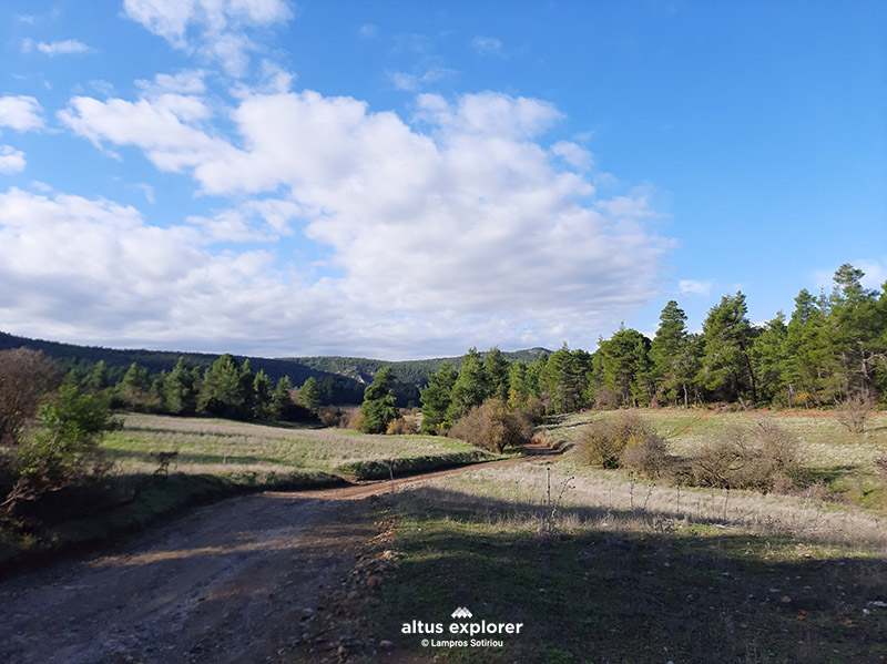 Forest road

- Bring plenty of water and food (if you walk the whole route. Count on the return journey).
- If you cross it in the summer, check if there is a curfew and carry a hat with you. (there are uncovered spots - not covered by trees)
- Do not cross it during periods of very high temperatures.

Upon completion of your hike, the following are suggested:
- You can walk (if you have time and stamina) a short route to the meadow with the chapel of Prophet Elias. Very beautiful place and suitable for a picnic (see map)

Χάρτης διαδρομής - πεζοπορίας
Ξεκλειδώστε τον αναλυτικό χάρτη πεζοπορίας Permium αυτής της διαδρομής, τα επιπρόσθετα χαρακτηριστικά της, όπως και όλους τους Premium διαθέσιμους πεζοπορικούς χάρτες με μια συνδρομή.

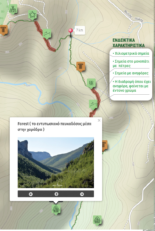
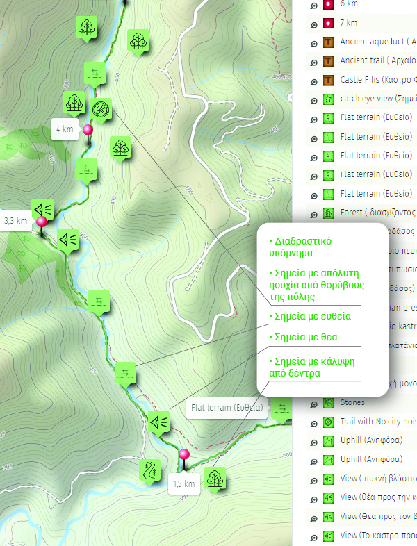
1. Ο Premium πεζοπορικός χάρτης περιλαμβάνει τα παρακάτω χαρακτηριστικά (όποια υπάρχουν στη διαδρομή):
- Σημεία στη διαδρομή με ευθεία, με ανηφόρα (και με έντονο χρώμα), κατηφόρα.
- Σημεία στη διαδρομή με πέτρες (εφόσον υπάρχει)
- Σημεία φυσικού ενδιαφέροντος (με πυκνό δάσος, με δέντρα, χαμηλή βλάστηση, ποτάμια, καταρράκτες, σπηλιές, λίμνες κτλ)
- Εκτυπώστε τον χάρτη για backup (διαθέσιμο μόνο για μεγάλες διαδρομές)
- Σημεία γενικού ενδιαφέροντος (σημεία με θέα, πολιτιστικά μνημεία, αρχαιολογικοί χώροι, κτλ)
- Χιλιομετρικές αποστάσεις, σημεία έναρξης
- Σημεία ενδιαφέροντος με φωτογραφίες
- Catch eye points για φωτογράφιση και video
2. Επιπρόσθετα χαρακτηριστικά διαδρομής
- Download GPΧ
- Πως θα φτάσετε στο σημείο εκκίνησης
- Πλοηγηθείτε στον χάρτη με εντοπισμό της θέσης σας χωρις να κατεβάσετε εφαρμογή (ΒΕΤΑ - προσωρινά δοκιμαστική έκδοση)
Διαθέσιμος με συνδρομή
Η παρακάτω εικόνα είναι γενικό παράδειγμα experience map με καποια από τα χαρακτηριστικά του και όχι τμήμα της παρούσας διαδρομής.