Evia: Dirfi, Hiking trail, a unique photographic experience

Nature and creation: Exploring hidden natural surrealistic images!
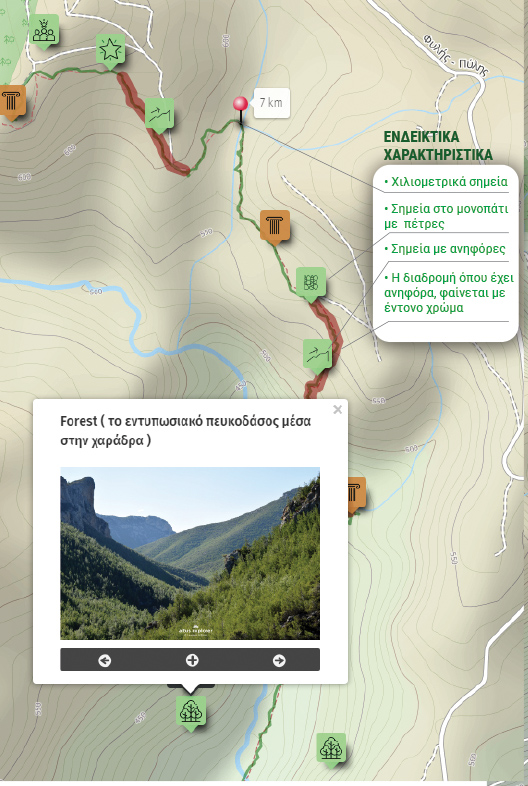
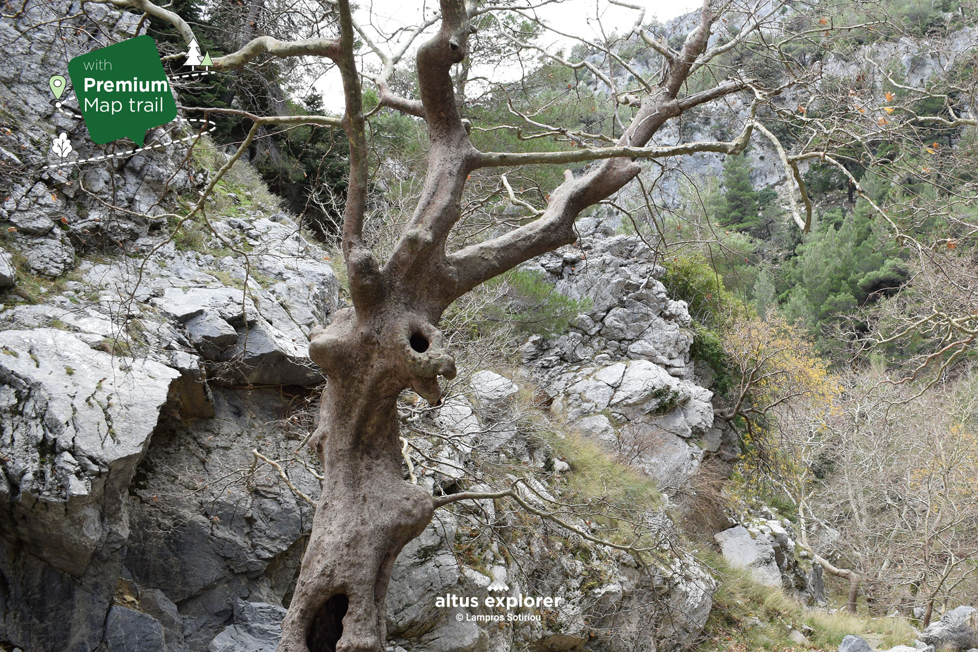
Hiking in central Evia is an incredible experience in nature with many natural creative surprises! Visitors have the opportunity to walk beside a quiet river, passing through beautiful plane trees that create a natural canopy over their path. All along the way, the trail crosses an impressive canyon, surrounded by wild rocks carved by nature, trees with strange shapes, images that create an enchanting surreal atmosphere for anyone who wants to see the nature around us..... and with a creative eye!
At the end of the trail we come across a paradise of fir forest. The tall fir trees have taken various dynamic shapes, as if dancing to the rhythm of the strong winds of the region.
This hike represents more than just a journey, but an initiatory experience into the world of nature, an adventure that will remain unforgettable in the memory of every visitor.
![]()
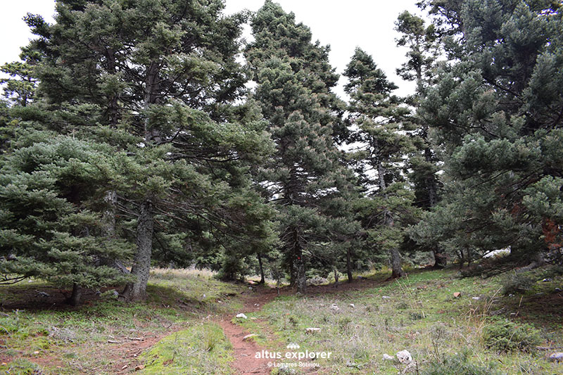 The trail enters a fir forest
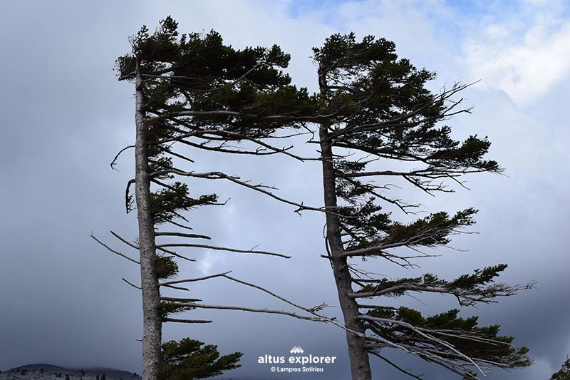 Fir trees with impressive shapes as if moving against the wind!
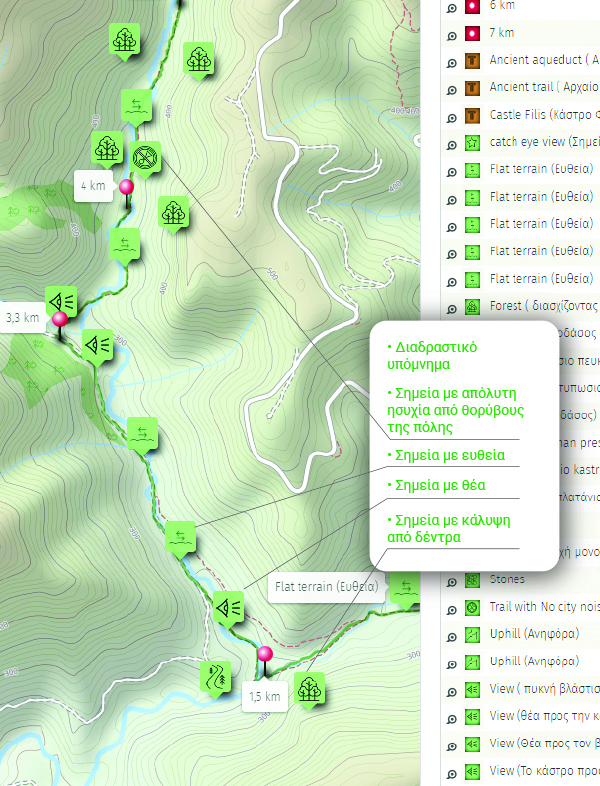
On this hiking route you will see (available on activation of the premium version):
- More photos of the route(description & map)
- More surreal images created by nature and worth seeing (description & map)
- How to get to the start of the trail(description & map)
- Where on the trail there is a straight path and how to get there. ( map)
- In which parts of the trail there are hills and terrain morphology e.g. stones(map)
- Points that will inspire you to take photos or videos(description & map)
- Many points of interest such as with a view, for relaxing in nature, places without city noise etc.(description & map)
- After the ride what you can do as well as other technical features and functions

- Have plenty of water and food with you (assuming you walk the entire route. Also consider the return trip).
- If you cross it in the summer, check if there is a traffic ban in the area.

Χάρτης διαδρομής - πεζοπορίας
Ξεκλειδώστε τον αναλυτικό χάρτη πεζοπορίας Permium αυτής της διαδρομής, τα επιπρόσθετα χαρακτηριστικά της, όπως και όλους τους Premium διαθέσιμους πεζοπορικούς χάρτες με μια συνδρομή.

1. Ο Premium πεζοπορικός χάρτης περιλαμβάνει τα παρακάτω χαρακτηριστικά (όποια υπάρχουν στη διαδρομή):
- Σημεία στη διαδρομή με ευθεία, με ανηφόρα (και με έντονο χρώμα), κατηφόρα.
- Σημεία στη διαδρομή με πέτρες
- Σημεία φυσικού ενδιαφέροντος (με πυκνό δάσος, με δέντρα, χαμηλή βλάστηση, ποτάμια, κτλ)
- Εκτυπώστε τον χάρτη για backup (διαθέσιμο μόνο για μεγάλες διαδρομές)
- Σημεία γενικού ενδιαφέροντος (σημεία με θέα, πολιτιστικά μνημεία, αρχαιολογικοί χώροι, κτλ)
- Χιλιομετρικές αποστάσεις, σημεία έναρξης
- Σημεία ενδιαφέροντος με φωτογραφίες
- Catch eye points για φωτογράφιση και video
2. Επιπρόσθετα χαρακτηριστικά διαδρομής
- Download GPΧ
- Πως θα φτάσετε στο σημείο εκκίνησης
- Πλοηγηθείτε στον χάρτη με εντοπισμό της θέσης σας χωρις να κατεβάσετε εφαρμογή (ΒΕΤΑ - προσωρινά δοκιμαστική έκδοση)
Διαθέσιμος με συνδρομή
Η παρακάτω εικόνα είναι γενικό παράδειγμα experience map με καποια από τα χαρακτηριστικά του και όχι τμήμα της παρούσας διαδρομής.