altus explorer altus explorer
  • Hiking trails in Greece
    • All hiking trails
    • Places for hiking
      • Attiki
      • Euboea Island
      • Peloponnese
      • Thessaly
    • Mountain maps
  • Premium
  • Articles
  • About the project
  • My trails
    • Trails with Premium maps
    • Saved routes
  • Register / login
  • Contact
  • Greek
  • English (United Kingdom)

Meteora: Hiking trail for everyone

  • basic
f Facebook Share

Μετεωρα μονοπάτι πεζοπορίας


hiking trail in greece


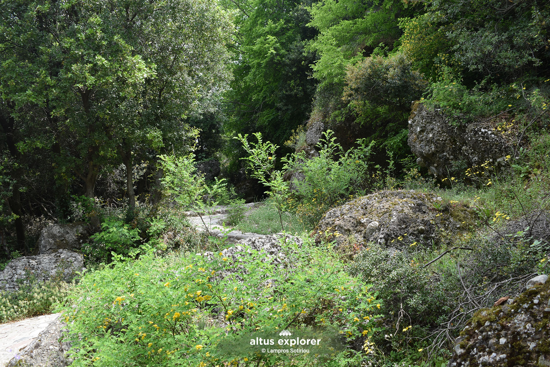
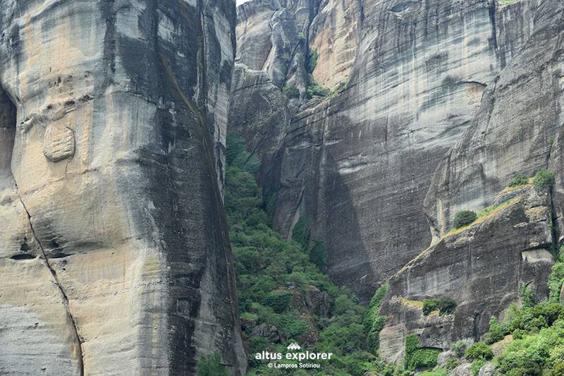
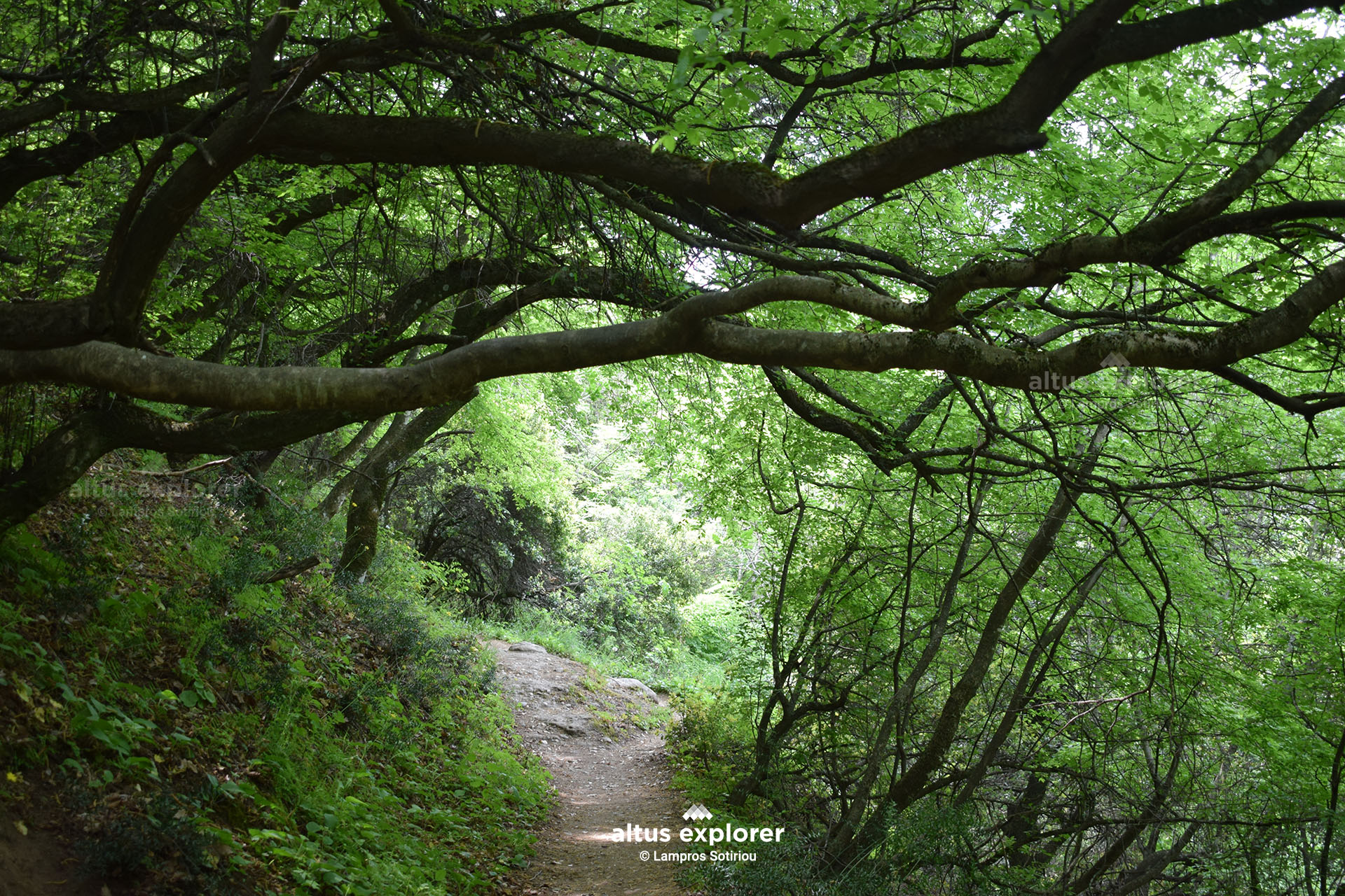
From the northern part of Kalambaka starts one of the most classic and popular hiking trails, which leads to the Monastery of Agia Triados. The trail is in excellent condition (like almost all trails in Meteora), crossing an area with rich vegetation of olive, holly and beech trees. The harmonious coexistence of nature with the impressive rocks of Meteora creates a unique and exciting hiking experience for everyone!


Μετέωρα μονοπατι


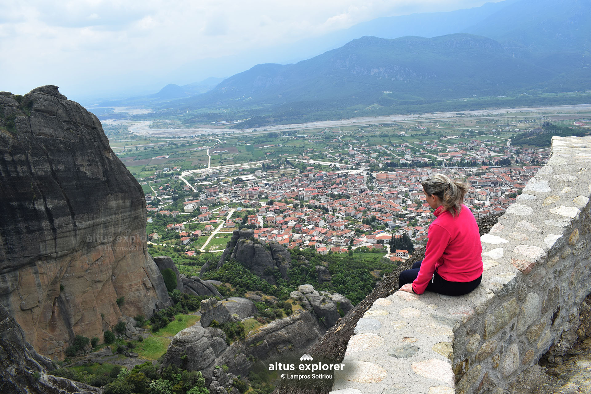
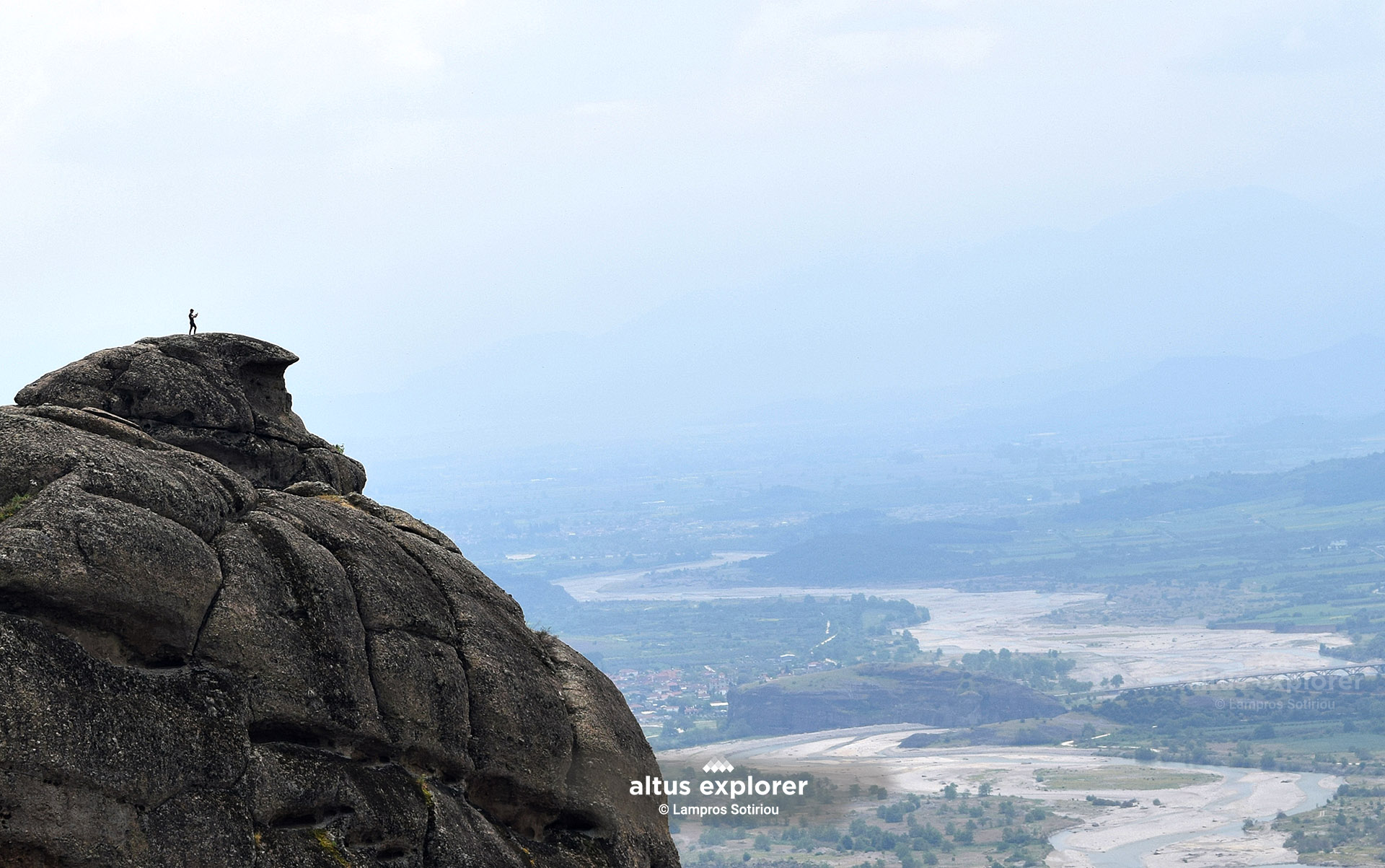
The route is generally easy, although from about the middle of the route onwards there is a steady uphill gradient. During the course, there are many points with panoramic views of the town of Kalambaka, the Thessalian plain and of course the impressive rocks of Meteora.


point to trail

Μετεωρα
Μετεωρα


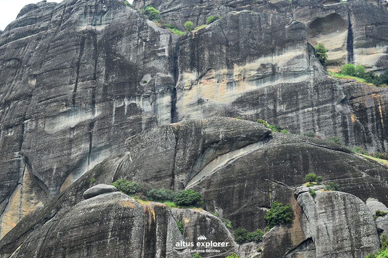
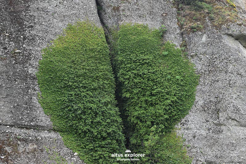
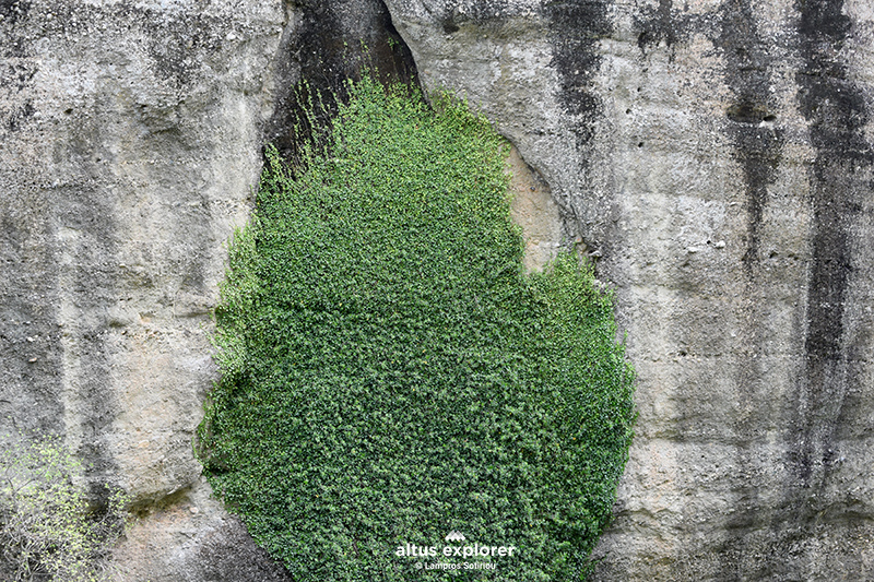
Do not miss to observe the unique low but rich vegetation, as well as the climbing plants that hug the rocks, forming special and impressive patterns.


point to trail

Μετεωρα
Μετεωρα


Μετεωρα μονοπατι


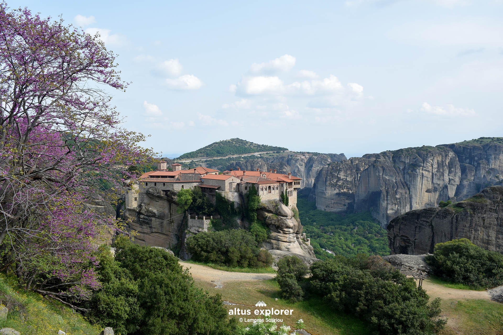
At the end of the route you will reach the Monastery of the Holy Trinity. However, be sure to check the opening hours in advance if you wish to visit it. Note also that, to reach the monastery, an extra "challenging" climb is required through a path with steps carved into the rock.


point to trail


Μετεωρα


point to trailDSC 0941


Χαρακτηριστικά πεζοπορικής διαδρομής
Χρόνος πεζοπορικής διαδρομηςHiking time: 45 minutes (one direction)
Δυσκολία ΔιαδρομήςRoute difficulty: 2/5
Μήκος πεζοπορικής διαδρομηςRoute length: 1,2 km


Τύπος πεζοπορικής διαδρομηςType of route: trail 
ΕποχήBest season: All (not in high temperature season)
Βλάστηση πεζοπορικής διαδρομήςMain vegetation: beech


Ανηφορικό μονοπατιUphill 0,8km
μονοπατι ευθειαLevel section: 320m
κατηφορικό μονοπάτιDownhill: 0,4 km
Experiences
Available in premium version
Καταγραφές πεζοπορικών διαδρομών, φωτογραφίες, πεζοπορικοί χάρτες:
Altus Explorer © - Λάμπρος Σωτηρίου

© 2010 - 2025 Altus Explorer. All rights reserved | A business unit of Oxygen Design.
(Αρ. ΓΕΜΗ: 63341503000)

  • Hiking trails in Greece
    • All hiking trails
    • Places for hiking
      • Attiki
      • Euboea Island
      • Peloponnese
      • Thessaly
    • Mountain maps
  • Premium
  • Articles
  • About the project
  • My trails
    • Trails with Premium maps
    • Saved routes
  • Register / login
  • Contact