
Find the best
hiking trails
& mountain maps
in Greece
hiking trails
in Greece
according to your abilities & your moods
Find the best
hiking trails
& mountain maps
in Greece
hiking trails
in Greece
according to your abilities & your moods


Technical characteristics & tools for trails - routes
- Modern, friendly & easy route presentation interface
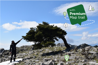
- Professional photos at the most important points of the trail in Greece
(more material on the routes marked Premium map trail) - Featured photo/video spots
(available on routes marked Premium map trail) - What to look out for on the trail
- Exit points from the route
(available on routes marked Premium map trail) - Technical characteristics (distances, vegetation, time, difficulty, experiences offered, uphill, downhill, straight, etc.)
- How to reach the trailhead or the hiking trail
(available on routes marked Premium map trail) - On line route storage
(available on routes marked Premium map trail) - After the hike
(available on routes marked Premium map trail) - Download Gpx of the route / trail
(available on routes marked Premium map trail)

Search for routes using filters
Search trails in most famous mountain areas of Greece with filters
Options such as:
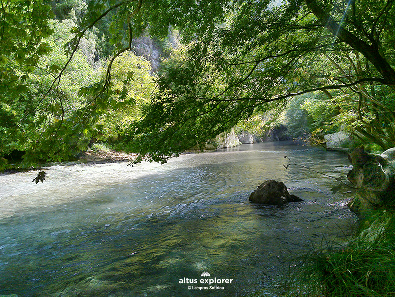
- Natural features (rivers, lakes, waterfalls, caves, national parks)
- Experiences (hiking, biking, mountain running, with a view, without city buzz, sense of mystery, adventure, photo spots, etc.)
- Vegetation.
- Areas (P.E.)
- Route type.
- Route difficulty

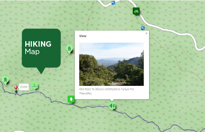
Maps of Greek hiking routes - trails
- Large on-screen route map with "clean" & modern design
- Trail map with physical features on the map (uphill, steep, downhill, straight, with stones), points of interest, experiences offered by the trail, mileage, viewpoints, etc.
(more material on routes marked Premium map trail) - See photos on the map in selected parts of the trail or suggested places for photography/video
(available on routes marked Premium map trail ) - Print the map on A4 or A3 with a full image of its features for backup.
(available on routes marked Premium map trail) - (Geolocation) See your position on the map when you are on the trail, with all its features directly from your browser without downloading an app - BETA
(available on routes marked Premium map trail) - General map of Greece with all trails marked Premium map
(general map of Greece with all trails - trails marked Premium map trail) available soon - Interactive map memo

(soon available in English)

Hiking trails in Greece
.... for everyone!
Altus Explorer is a specialized catalogue with hiking routes - trails, maps of routes, points of interest and experiences offered by the Greek Mountains.
The catalogue and the categorization of the hiking routes - trails are created by on-site research exclusively by the administrator and creator of Altus Explorer .
During the hike, every detail is recorded, such as the morphology of the terrain, vegetation, fauna, natural features, dangerous points and experiences that each route offers.
With this information, you can make personalized searches for hiking routes according to your interests and capabilities, view maps of mountains with rich features and all this in an easy, easy to use and friendly environment!
The project is regularly updated with new routes, features and functions!
Happy trails to all!!!


The creator of Altus Explorer
Lambros Sotiriou is a professional graphic designer and photographer, engaged in mountain hiking and trail recording. His love for mountain nature is the driving force to create this project in order to highlight its uniqueness with a different and creative perspective, through his personal view and his experience!
All hiking routes - trails in Altus Explorer are selected based on the following characteristics:
- The trails are in good condition
- They are paths and forest roads with few branches.
- They have many points of interest and create unique experiences.
- Most are close to cities
- They are easily accessible
- Routes are updated and checked at regular intervals.